

THE LONG WAY DOWN UNDER
New Zealand’s TE ARAROA Trail is a 1,860-mile route traversing the length of the country from the tip of the NORTH ISLAND to the bottom of the SOUTH, through some of the wettest, WILDEST, and roughest OUTBACK imaginable
 As I made my careful way up the flooded riverbed, the raging ice-cold waters swirling around my waist, I thought to myself: ‘this is like no other hiking trail I have ever seen’. I pushed on up the stream, fighting the current to stay on my feet. Adrenaline coursed through my body as I raced up the valley to beat the approaching storm.
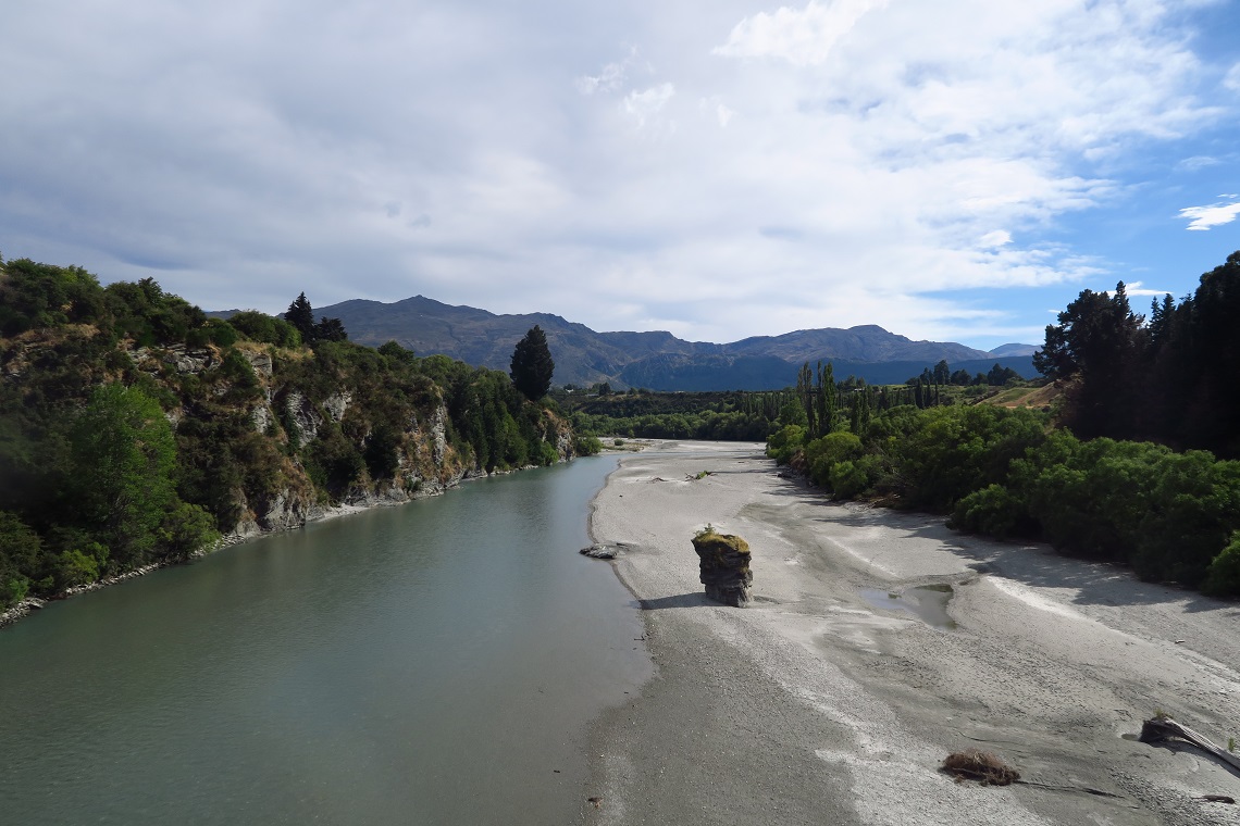
There was no path to speak of. The riverbed was the path, and the recent rains had made it swollen and angry.
The sheer sides of the gorge rising up on either side of me provided no relief, and it was still a long way to the top. With black clouds looming ever closer in the distance, I knew I would have to be quick if I wanted to outrun the natural force of a New Zealand thunderstorm.
SETTING OFF
Wind back three months to the start of this adventure.
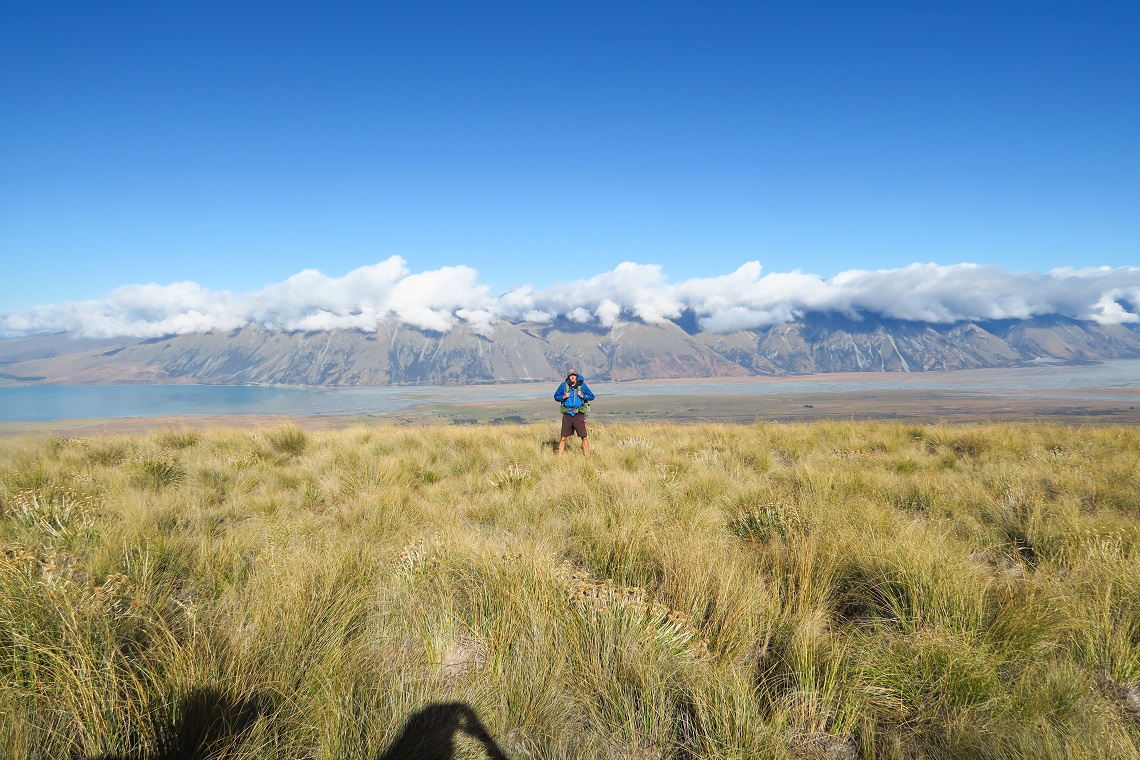
As I began my 22-hour flight from Heathrow to Auckland, I had little idea of the excitement that lay ahead. I was about to begin Te Araroa, a 1,860-mile hiking trail traversing the length of New Zealand. Beginning at the tip of the North Island, winding all the way down to the coastal town of Bluff in the south, Te Araroa had been on my bucket list for a while. I’d already ticked off many of the big trails around the world, including the Pacific Crest Trail, and I’d always wanted to visit New Zealand. What better way to experience a nation than to walk the length of it?
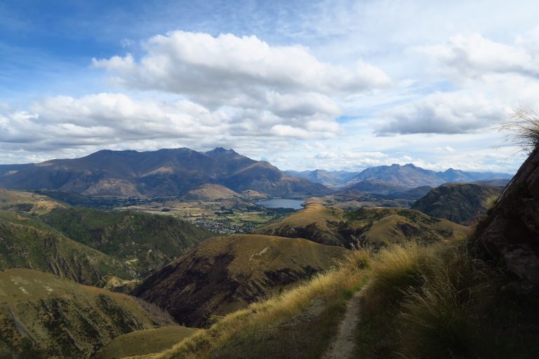
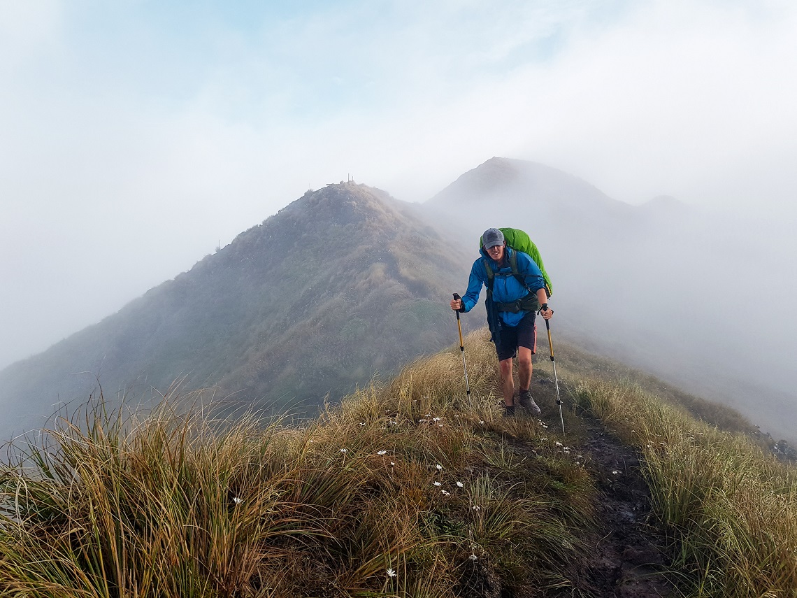
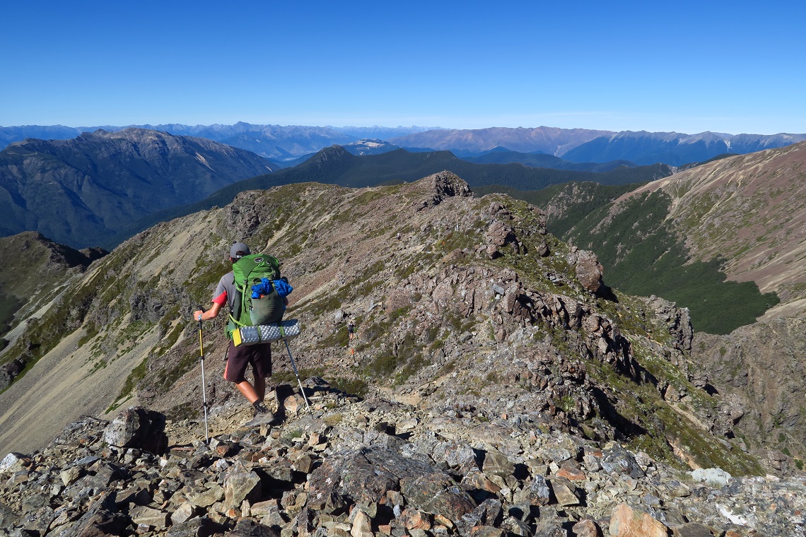
Te Araroa is a Maori name that literally translates as ‘The Long Pathway’. The trail opened in 2011 and being relatively new, hasn’t yet reached the high-profile status of its more famous counterparts around the world such as the Appalachian Trail or the Camino de Santiago. As such, it’s still a little rough around the edges. Much of the trail is minimally maintained and some navigation skill is required to find a way through the more remote areas.
While many trails generally take the most practical route through valleys and over mountain passes, Te Araroa follows the scenic route at any cost. This results in a trail full of impossibly steep climbs and overgrown or non-existent paths.
Three months in, I was well into the South Island and had just finished the most stunning section of trail so far — a five-day traverse of the glorious Richmond Ranges. The next stage, from the hamlet of Boyle Village to the ski haven Arthur’s Pass, was notorious for the number of serious river crossings. And to make matters worse, the weather forecast was not looking good.
As any experienced tramper will tell you, the biggest danger in the New Zealand outback is rivers. Te Araroa crosses multiple water sources of varying sizes. Most of these crossings are perfectly straightforward in ideal conditions, but after periods of prolonged rainfall they can be lethal. A peculiar combination of New Zealand’s geology, topography and weather causes rivers to rise alarmingly quickly in heavy rain. Any hiker caught out in a storm will face rising waters that can swell by over a metre in a matter of hours.
Not one to be deterred by such warnings, I collected my resupply box and pressed on towards Hope Shelter, my base for the night. The New Zealand wilderness is littered with huts built to accommodate trampers overnight. These shelters range in quality from pristine mountain idylls to squalid rat-infested shacks, and you rarely know what you’re going to get until you arrive. This was one of the latter, and moments after lying down on one of the four bunks, a quick glance up at a ceiling crawling with spiders had me heading for the door and pitching my tent outside.
GETTING WETTER
The promised poor weather arrived overnight, and I set off the following day without seeing a single soul all morning. The first few miles followed the course of the Hope River, which yesterday had been crystal-clear and slow-moving, but was now a murky torrent of brown water and debris from last night’s storm. I had to cross and recross this river numerous times on shaky wire bridges which swayed violently in the wind.
As the weather worsened and rain bucketed down into the evening, I reached the safety of Hurunui Hut. I had heard other hikers compare it to a dingy opium den, but at the time it seemed to be the cosiest paradise imaginable, emerging out of the misty forest with smoke billowing from the chimney like a storybook cottage.
Inside I met Ryan, who had set off northbound from Arthur’s Pass a few days before. He had already set up home for the night and had a roaring fire going. We dried our clothes and chatted about the obstacles we’d tackled so far. He had definitely had it a lot worse than me. He was more or less out of the woods while I was very much heading into them.
As we cooked our dehydrated meals over our camping stoves, he took out his phone and put on a film for us to watch. Appropriately he chose The Perfect Storm, a disaster movie in which multiple people die as a result of adverse weather. Not the most comforting option.
Belly full and joints warmed up, I headed to bed for an early night, yet sleep took a long time to come. My mind was occupied by the relentless rain outside and the thought of the rising waters on the trail ahead.
STRANDED
The hammering on the corrugated metal roof ceased in the early hours and the morning broke with a burst of sun. Warmth was in the air, but I wasn’t in the clear. Rain had been falling all night and the water levels would remain high for a long time. My day started with a scramble up a heavily eroded path along a narrow creek bed. What was usually nothing more than a gentle stream had become a waterfall overnight, ready to knock me off my feet at the slightest misstep. I had to cross the water repeatedly, each time spending several minutes carefully assessing the safest point to cross.
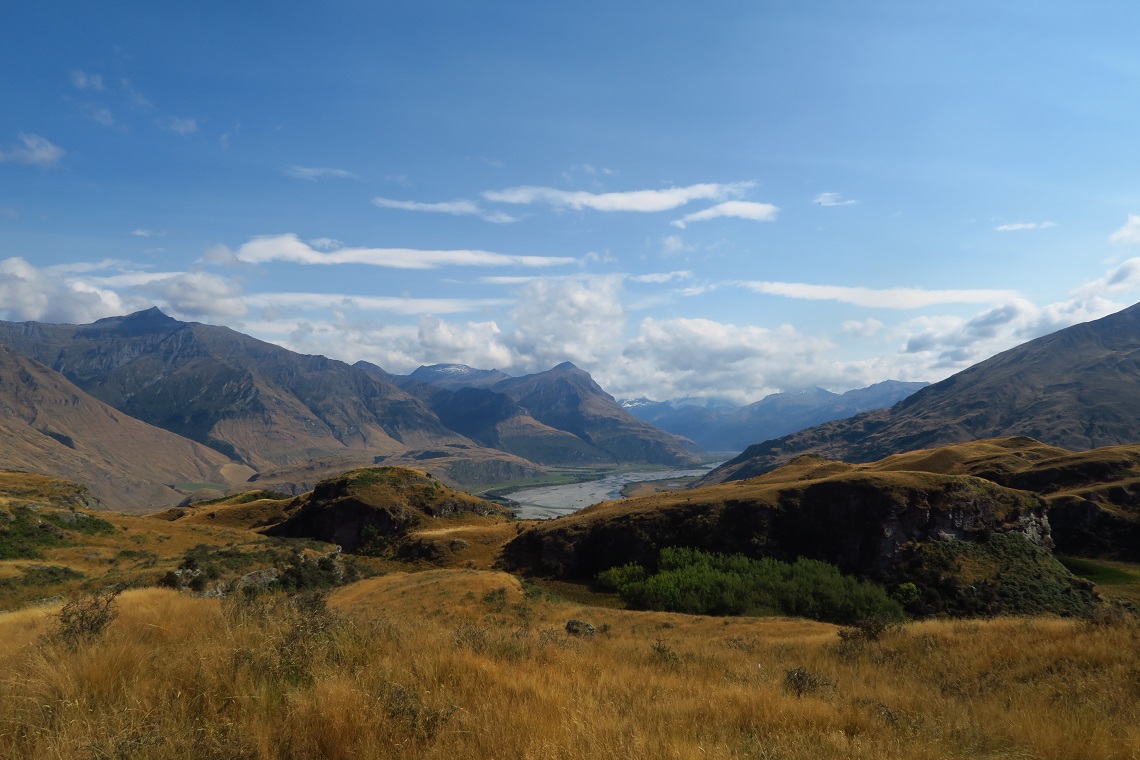
I reached the top of the pass and took a few moments to catch my breath while looking out upon the sweeping vista to the south. A beautiful ocean of green broken by the glistening silver ribbon of the Taramakau River. I was unable to enjoy the view too much as I knew I’d have to cross it soon enough. I clambered down the other side to Locke Stream Hut, feet and trousers soaked. Stopping inside for lunch, I met Brienne and Devin, two American sisters who were recovering from a traumatic ordeal the night before.
Late in the day, they’d become stranded by rising rivers. Unable to go forward or back, they were forced to set up their tent on a small outcrop of dry land and had spent the night checking the status of the waters around them. Luckily, by mid-morning the flood had subsided enough for them to proceed, so once they reached the hut, they’d decided to spend a few hours recuperating. I didn’t blame them.
Refreshed and refuelled, I left them in the hut and very soon reached my first crossing of the Taramakau River. It was gushing full force and looked powerful. I couldn’t believe it was usually tame enough for hikers to get across. I braced myself and adopted the proper technique. Facing upstream, legs apart, using my trekking poles for support and keeping three points of contact with the riverbed at all times, I shuffled across slowly and carefully. Instantly I felt the force of the current buffeting my ankles and the feeling only worsened as I submerged myself deeper into the water.
I made it almost halfway, but the water was too powerful, and I retreated. I tried once more but was unable to break the mental barrier to get myself to the other side. Eventually, I gave up and decided to wait it out in the sunshine. I was in no hurry and the weather was beautiful. Lying on my back with my head in the clouds, I don’t know how much time had passed when I heard voices on the opposite bank. Brienne and Devin were ambling along without a care in the world. I called over to them and they pointed me upstream to a safer crossing point they had found. The river had subsided slightly in the last hour and I managed the crossing with ease.
THREE’S COMPANY
The three of us spent the afternoon walking together, headed towards the confluence of the Otehake and the Taramakau rivers, which we knew would be the most difficult crossing yet. We had heard tales of a hiker getting swept off his feet here, becoming stranded on an island in the middle of the rising river and having to be rescued by helicopter. We were comforted by the fact we weren’t alone.
It also turned out they had a fairly large bone to pick with me. As I said goodbye to them in the hut that morning, I had absentmindedly locked the door behind me. When they went to leave, they realised they were trapped inside and had to climb out the hut’s tiny window to escape. Fortunately, there were no hard feelings and we were able to laugh about it.
We reached the confluence late in the day and spent ages scouring the banks for the best crossing point. Taking turns to test the waters, we made multiple attempts, but the river was so murky with glacial runoff it was impossible to accurately judge its depth. Whenever we found what looked like a passable crossing, we would get halfway before discovering it was far too deep to get across safely.
In the end, we made the executive decision to call it a day and stay put until morning. We had no idea what the weather would bring overnight so we crossed our fingers and prayed we had seen the last of the rain. We set up camp in the trees and cooked dinner, exhausted and soaked but drying quickly in the dying sun. Moments later we were driven inside by a swarm of biting sandflies, New Zealand’s national pest. Before we could sleep, we had to carry out the nightly ritual of killing any sandflies that had infiltrated our tents. The fine weather held overnight and the river had fallen just enough for us to cross the next morning.
The water was still well past our knees but we succeeded by adopting a technique the local New Zealanders use. Facing the current, we assembled in single file, each holding onto the shoulders of the person in front. Being the tallest of the group, I was at the back, while Brienne stood at the front bracing us with her trekking poles as we slowly but steadily shuffled across. I could feel all three of us starting to slip away in the current but we gritted our teeth and pulled through.
We were all physically and mentally exhausted by this point and didn’t want to cross another river ever again. Brienne and Devin made the smart decision to hop off-trail to a road where they could hitchhike to Arthur’s Pass. I was sorely tempted but my purist nature kicked in and I knew I wouldn’t be able to live with myself if I skipped any miles. I said goodbye and we arranged to meet up later on. There was one last section of trail left to go: The Deception-Mingha Track.
DEEP DECEPTION
The Deception-Mingha Track is a notoriously perilous section of Te Araroa and a key stage of the popular Coast-to-Coast ultramarathon race which takes place every year. It follows the course of the Deception River upstream to Goat Pass, before heading down the Mingha River on the other side. There is little-to-no path and the trail follows the riverbed the whole way. Hikers are advised not to attempt this section in poor weather, as the sheer cliffs on either side cause the river to rise extremely quickly, offering little chance of escape.
The river was high, but I was confident that I could do it. It was mid-afternoon and all I had to do was reach Goat Pass Hut by nightfall. My confidence was dented somewhat by a sign at the trailhead telling me it was eight hours to the top, but I remembered reading that the top ultrarunners complete the whole track in little over three hours. I wasn’t exactly an elite athlete but I knew my abilities and was pretty sure I could make it before dark. However, I had barely taken a single step when I felt a drop of rain on my arm.
A glance at the sky showed angry grey clouds rushing closer and closer. A storm was approaching, and I was going to have to outrun it. I should have turned back then. But instead, due more to an unwillingness to retrace my steps than anything else, I quickened my pace and rushed in. If there was any kind of path to speak of, I couldn’t find it. I simply had to make my way up the steepening riverbed as best I could. At one point I was wading up to my chest with my pack held above my head. Dry socks were a distant memory.
My trekking poles were my lifeline. I was putting all my weight on them and they served me well until I was suddenly swept off my feet. During one particularly forceful crossing, I was using all my waning strength to keep myself upright and foolishly made a hasty rush for the far bank. The moment I went for it I lost all stability and the icy current effortlessly toppled me over. I managed to save myself on a serendipitously placed rock but lost one of my trekking poles to the current. I felt a pang of sadness as I watched it floating away down the Deception River, gone for good.

What had I gotten myself into? The sky was now a sea of dark grey and thunder rumbled overhead. I had to keep going before it was too late. But my fall had robbed me of my confidence and now I was scared. I had come too far to retreat, and with looming walls of rock on either side, there was no escape from the river. My only option was to keep going until I reached the top.
For several hours, I climbed, scrambled and leapt across raging side streams without looking back. I dived through freezing waterfalls and plunged into chest-deep waters, barely feeling the cold. With each step, the top of the pass drew that little bit nearer, yet the daylight was waning at a frightening rate. The last thing I wanted was to be stuck out here in the dark.
The prospect of a warm bed and a hot meal kept me moving as I summoned up the last reserves of energy I had left.
Almost imperceptibly, the course of the Deception River narrowed, and the terrible force of nature withdrew its assault. Before I knew it, the river was little more than a gurgling stream around my feet. Eventually, I spotted the first glimpse of Goat Pass Hut, almost silhouetted against the murky evening sky. I clambered out of the water for the final time and trudged uphill to my bed for the night, just as the sun dropped below the horizon. I had made it, broken and traumatised, but relieved to be alive.
My heart was still racing as I squelched up the steps, peeled off my socks, and stumbled indoors to the bemusement of the hut’s three or four other occupants. As the wood fire brought blood back into my extremities, we exchanged horror stories from the day and discussed the outlook for the next morning.
WHO’S WRITING?
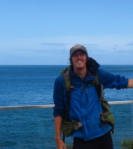 Charlie Knight is a freelance travel writer, mountain leader, and outdoor instructor. After quitting a nine-to-five in marketing to hike 2,650 miles along the Pacific Crest Trail from Mexico to Canada, he has managed to turn adventure into his full-time career.
Charlie’s other adventures include running across the Atacama Desert and bikepacking over 1,000 miles home from Gibraltar.
Follow him on Instagram: @charlieknight91