

A Swede, an Australian, an Italian and a Brit walk into a cable car. No, this isn’t a cheap joke – it’s the beginning of a high-level traverse of the Monte Rosa massif for the most confusingly international group I’ve ever seen.
There’s Tom, our Swedish guide who lives in Switzerland; Chad, who moved to London from Australia, and me, an Italian who doesn’t really know where he wants to live. The only consistent person is John, the scientist from Manchester. Over the next five days we’ll walk on the Rosa massif’s glaciers and summit as many of its 4,000m tops as we can.
The cable car climbs above the trees and into the clouds. Sitting inside, all we can see is drops of rain on the windows and a uniform shade of grey.
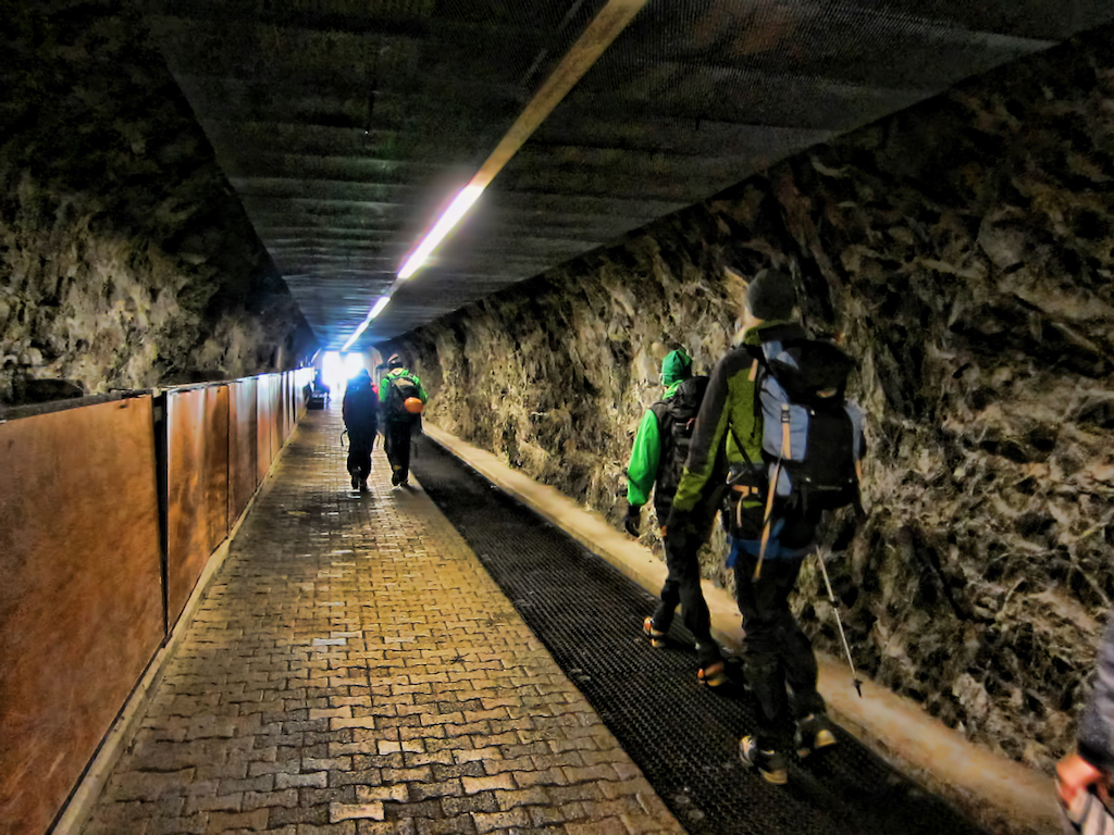
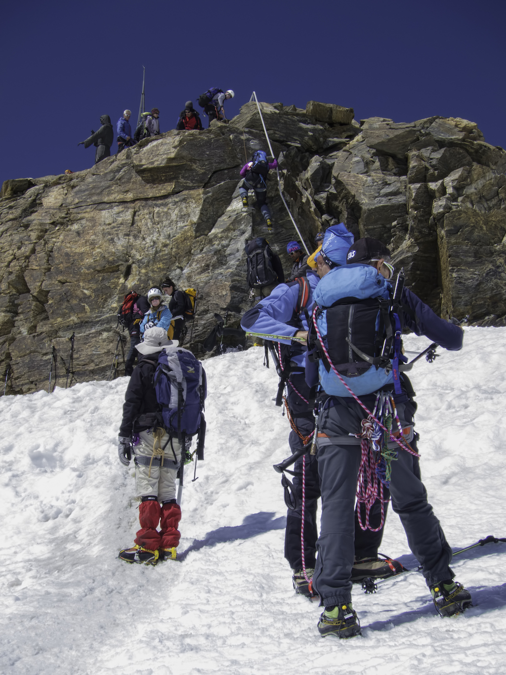
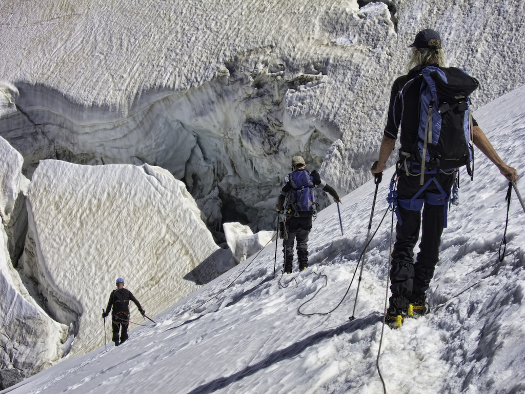
We reach the Klein Matterhorn station, high above the Swiss mountain town of Zermatt. Waterproofs, harnesses and rucksacks on, ice axe and crampons to hand, we head into the exit tunnel carved in the rock. A long line of neon lamps leads to a distant white light. The start of our journey.
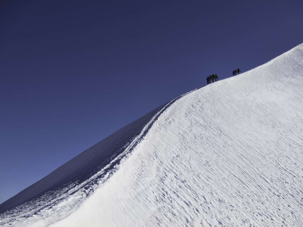
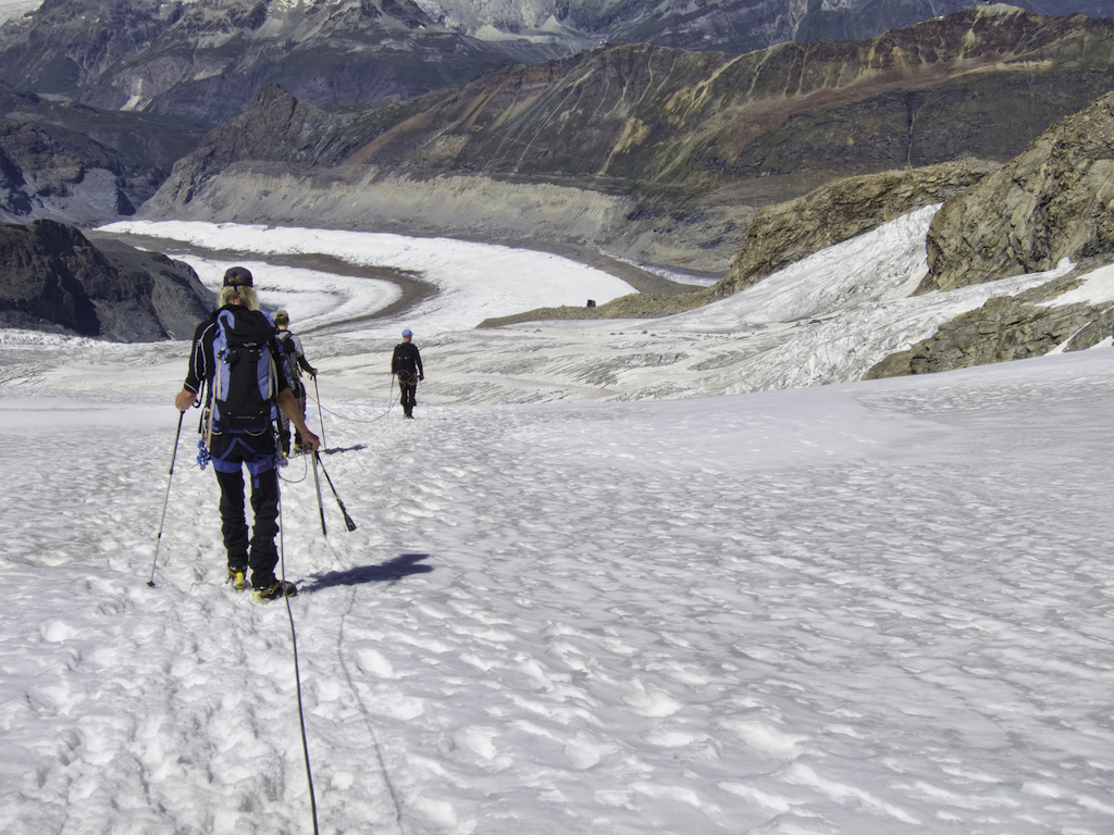
I put on my crampons and check the straps. Twice. We tie the rope to our harnesses. I look up at the Breithorn ridge stuck into the clouds; we take our first steps in the snow.
The first, short uphill stretch has all of us panting and sweating while Tom merrily whistles his way in front. Step, step, step, until the ground turns level. The wind picks up and tiny white spheres fall on the old snow. “Graupel,” says Tom. “Not here, not today, but this can be bad for avalanches.” We descend towards the Guide d’Ayas hut; the small, dark building appears and disappears as the wind throws wisps of clouds around.
Walking as a roped party requires a lot more discipline than I imagined: the rope has to be kept under a slight tension, never too loose or too tight, so I can’t stop for random faff breaks and photos. What’s worse, I can’t even chat the walk away as the nearest person is 10 metres ahead, almost lost in the fog and wind!
We make up for the missed talking once we’re around a table in the warmth of the hut. A group nearby plays cards with Monopoly money, while a young couple divides an apple on the plastic chequered tablecloth. The wind throws snowflakes against the windows.
“Smaller, smaller,” laughs Tom when the third glass of grappa comes his way, courtesy of the hut staff. “This will put me to bed even faster,” he adds as he downs the deceptively sweet and innocent-looking liqueur. We won’t need any help to go to bed early: we are getting up at 5am tomorrow, to summit our first 4,000ers – the mythological pair of Castor and Pollux.
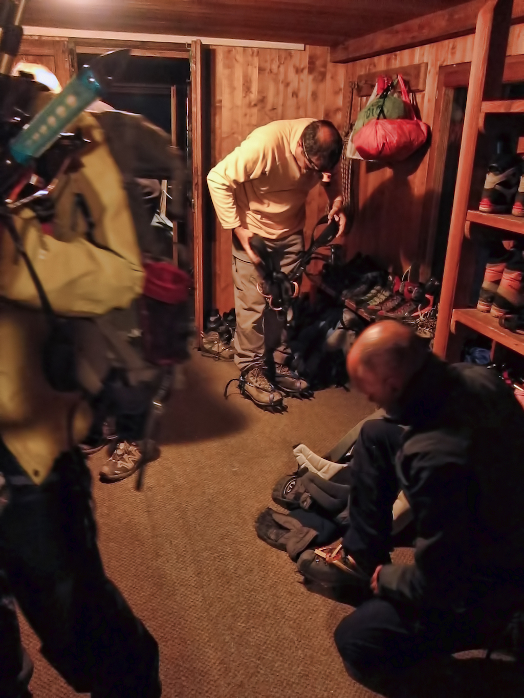
I am awakened by the simultaneous sound of the alarm and Tom’s voice – he obviously didn’t trust us on our first alpine start. “Holy macaroni!” he exclaims. “Have you guys been smoking sausages in this room?” How rude. The smell clearly comes from the other mountaineers in the dorm – I would suspect the German blokes in the corner who snored all night.
We all meet in front of the chequered tablecloth. I don’t feel particularly talkative or energetic but still manage to devour my entire allocation of stale bread, jam and biscuits. “Italians are good with food,” says Tom, whose brain clearly switches on a lot faster than mine in the morning, “but lousy with breakfast.” I nod silently in agreement, staring numbly at the bottom of an enormous bowl of watery coffee. It randomly surfaces to my consciousness that this is the first place where I’ve seen far more gents’ toilets than ladies’.
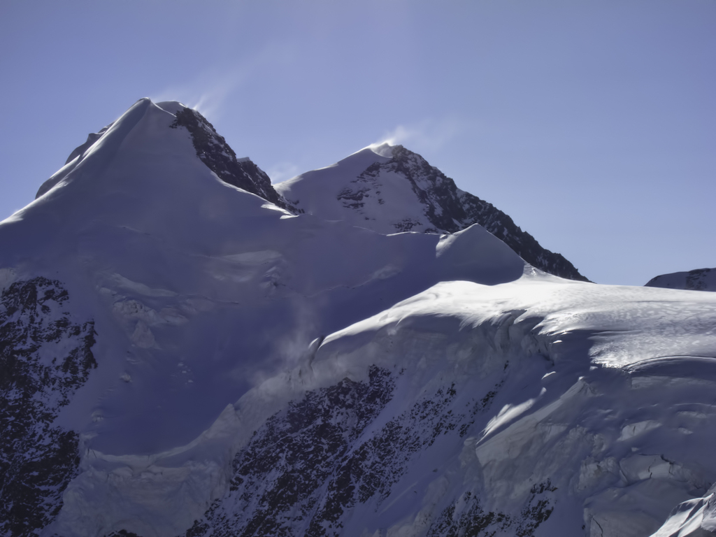
The sky at 5.30am is clear – at least, that’s what I gather through semi-closed eyelids. Crampons on, rope tied, we set off in the chilly air and fading darkness. It’s straight uphill: on and on we go towards the col between Pollux and Castor. As we climb, their tops are slowly touched by the first light.
The wind is freezing cold as we stop to remove our crampons and shorten our rope: there’s a rocky section to Pollux’s summit ridge. A bronze Madonna rests on the top; another small group is already there, busy with their crampons. We follow them slowly on the snow, all the way to the summit.
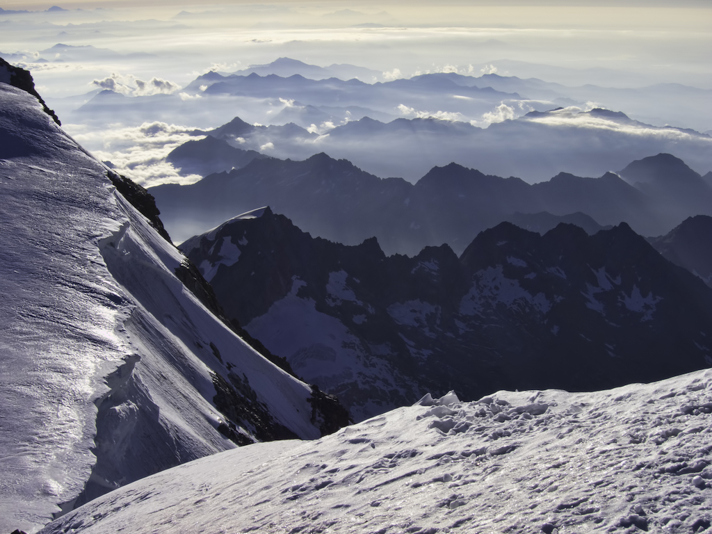
Yesterday’s clouds have vanished and it’s an outrageously clear day. The sky is the deepest blue, the light so bright it hurts. The wind blasts long streaks of snow off a nearby mountain called Lyskam’s graceful ridge.
Reaching Castor’s summit takes approximately forever. My silent struggle with the rope takes an age as I struggle with the slowing down and speeding up at every zig-zag on the increasingly steep, relentless slope. The other group is a handful of black dots scattered in the blazing white a long way down.
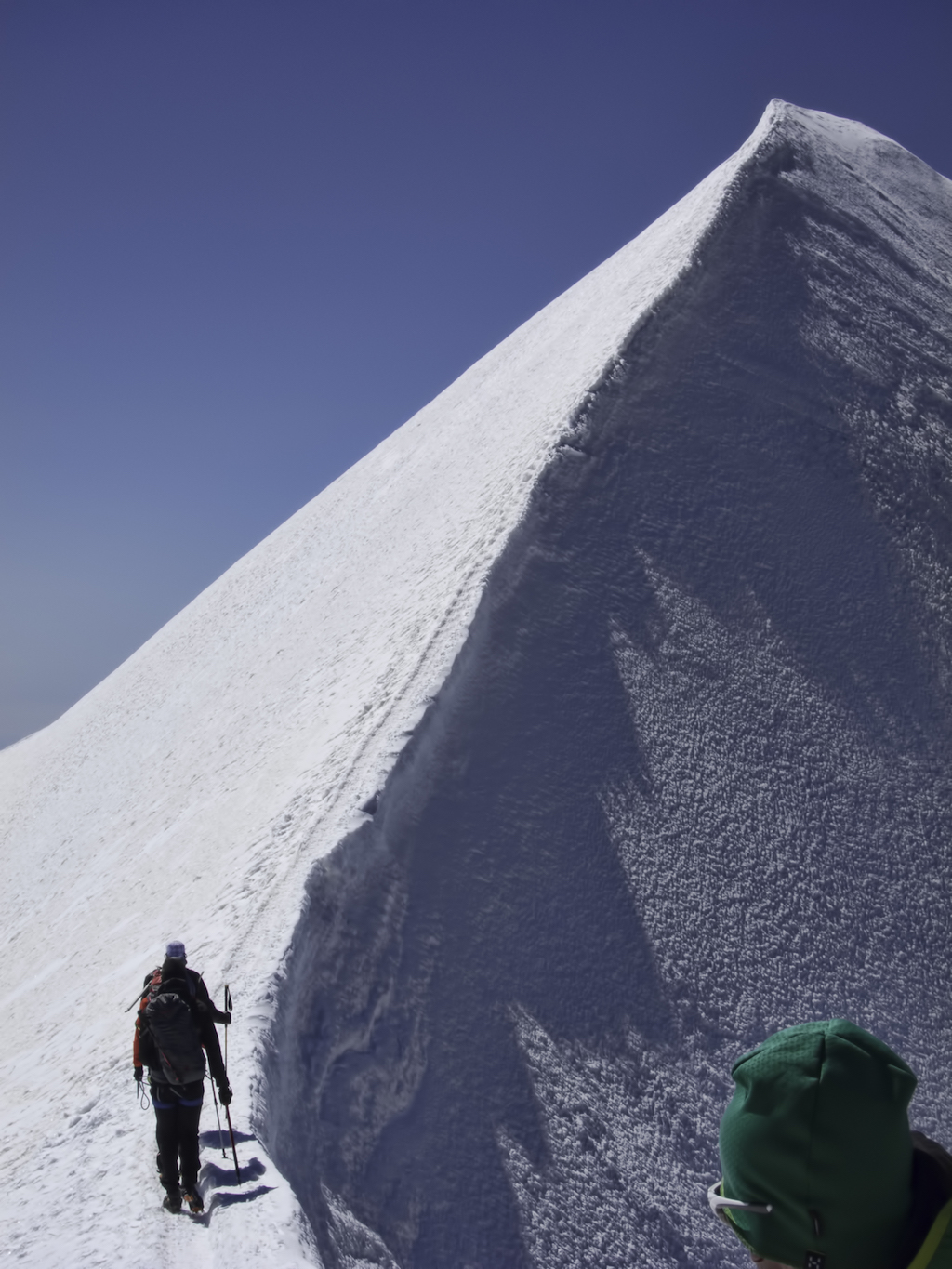
The ridge appears almost out of nowhere. It’s like the crest of a wave frozen in the sky. And it’s seriously thin – I decide to keep my eyes fixed on my boots rather than on the drop into Switzerland.
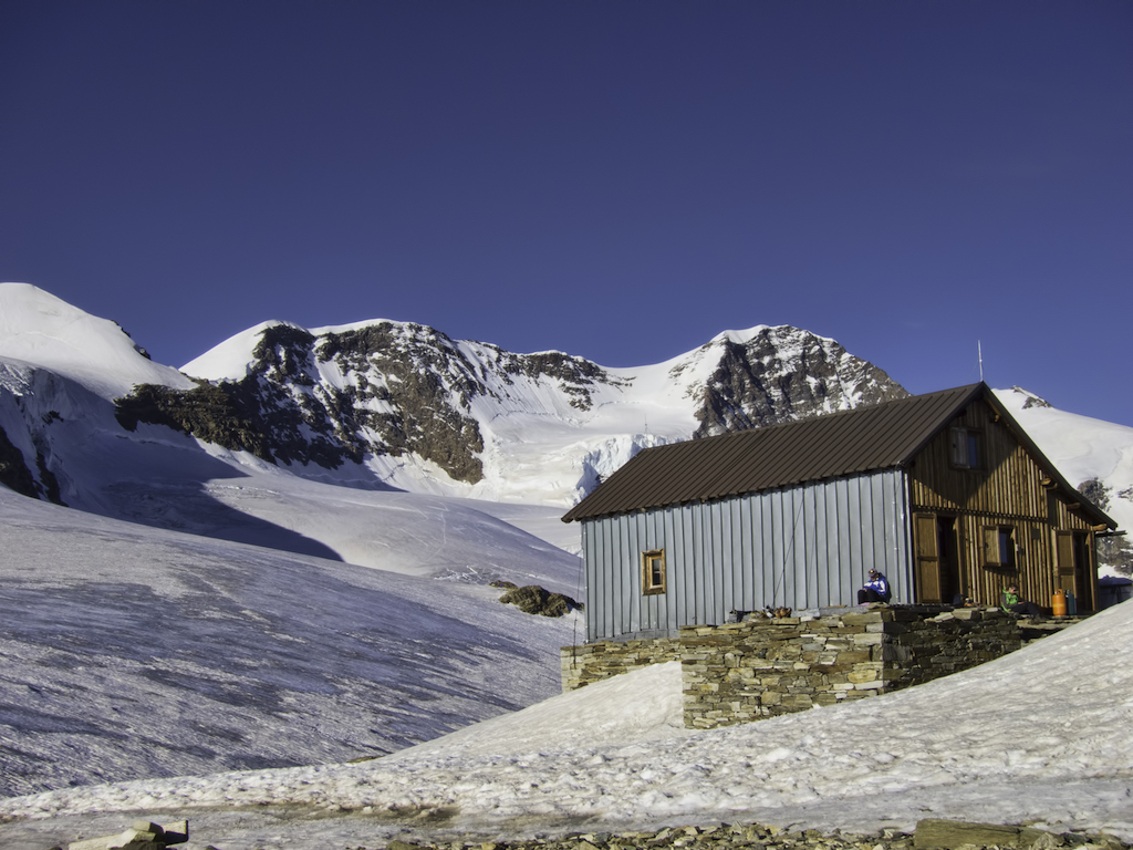
Later, at the Quintino Sella hut, hikers in shorts and leather boots arrive just as we take off our spikes and gaiters and leave them outside to dry. It feels like being at the border between two worlds: we all meet here and share a table, a warm dinner and a sleepless night before leaving in opposite directions at the break of dawn.
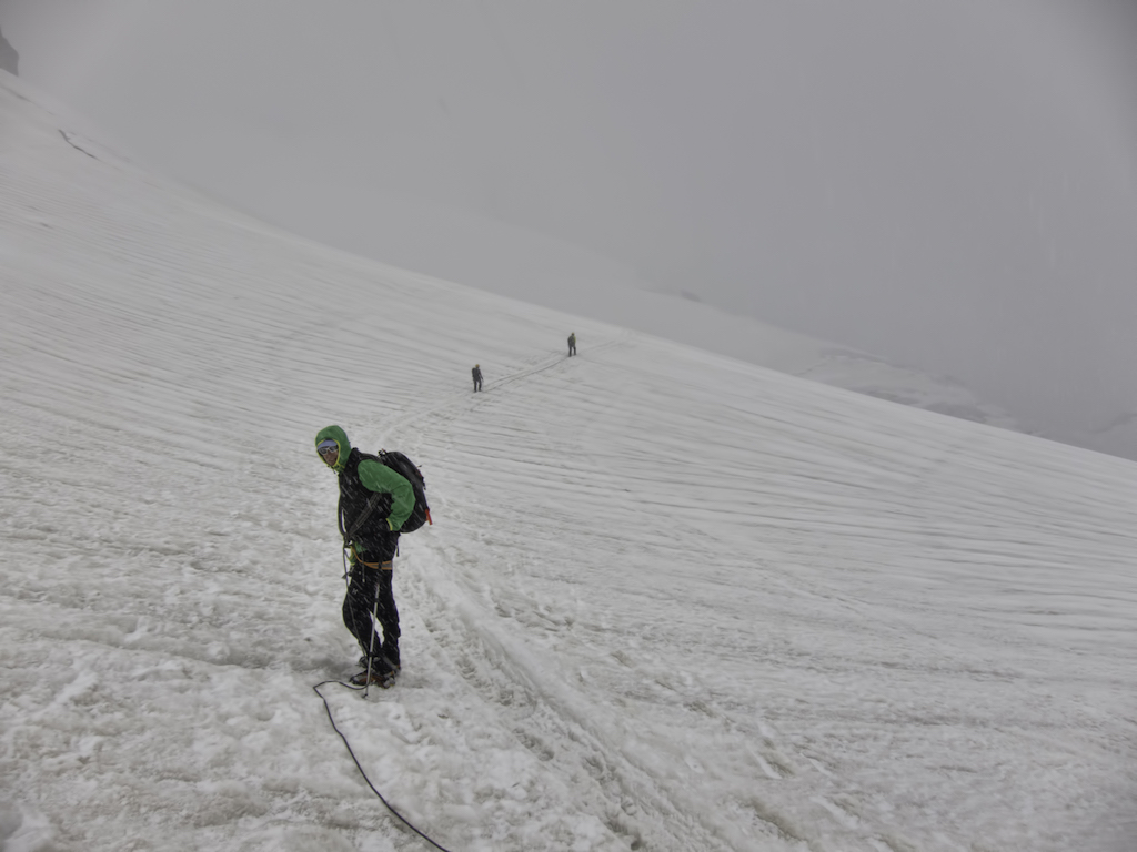
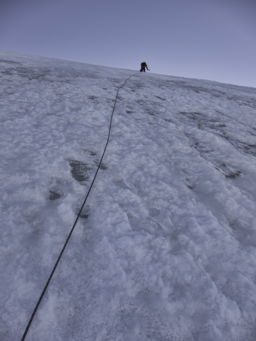
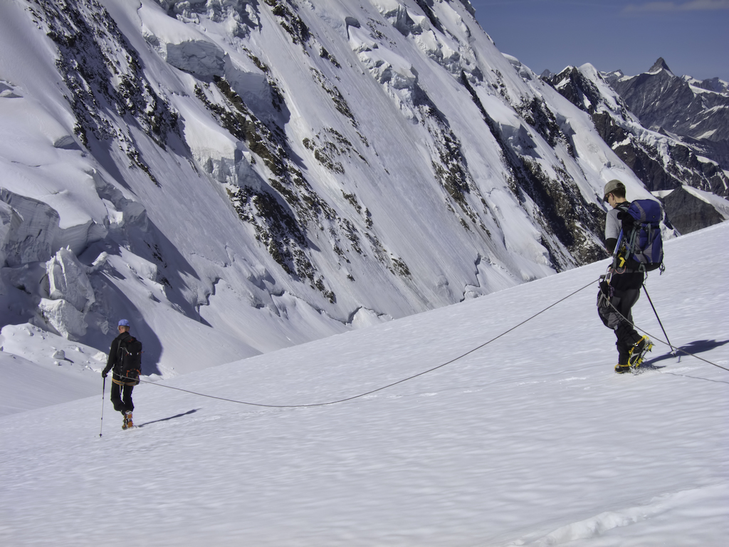
The next wake-up call is at 4am, and I confusedly wonder if we’re all part of a secret experiment in sleep deprivation. We start walking under a full moon. The glacier shines with a pale blue light and we hardly need our headtorches to follow the track. Showers of ice chips flush down the slope as we march.
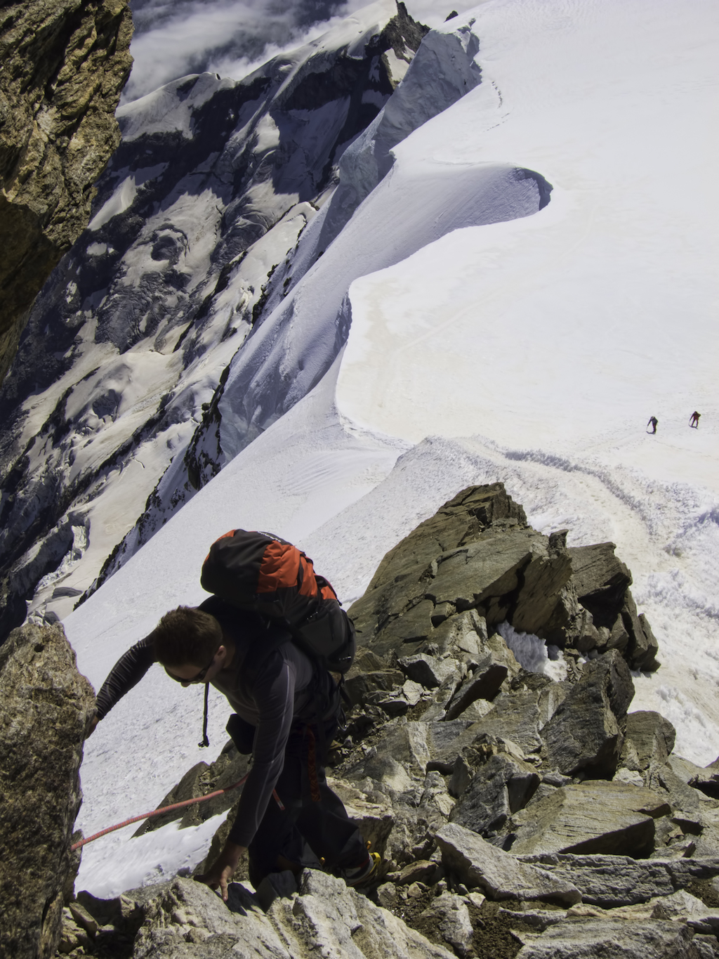
We are headed towards Lyskam’s Naso –‘the Nose’ – a subsidiary summit that stands between us and the Lys glacier. I feel a certain affinity for this top, although I’ll hasten to add that my nose is definitely the smaller of the two. We start contouring it, then turn directly up a near-vertical slope, secured by Thomas with ice-screw pitches. Well, OK, maybe it isn’t quite vertical, but you get my point…
We reach the top and stand still. The Lys glacier shimmers in the midday sun, the Rosa summits emerge from the sea of ice. “See that line in the middle?” asks Tom. “It’s the Monte Rosa highway. Everyone walks up and down there – you wouldn’t believe how crowded it gets on a clear day.”
We don’t linger too long: everything on the mountains is done with a sense of urgency, even rest stops. Soon we are working our way down and up again towards the highway. It’s hot work. We strip down to our baselayers, almost wishing for yesterday’s icy wind.
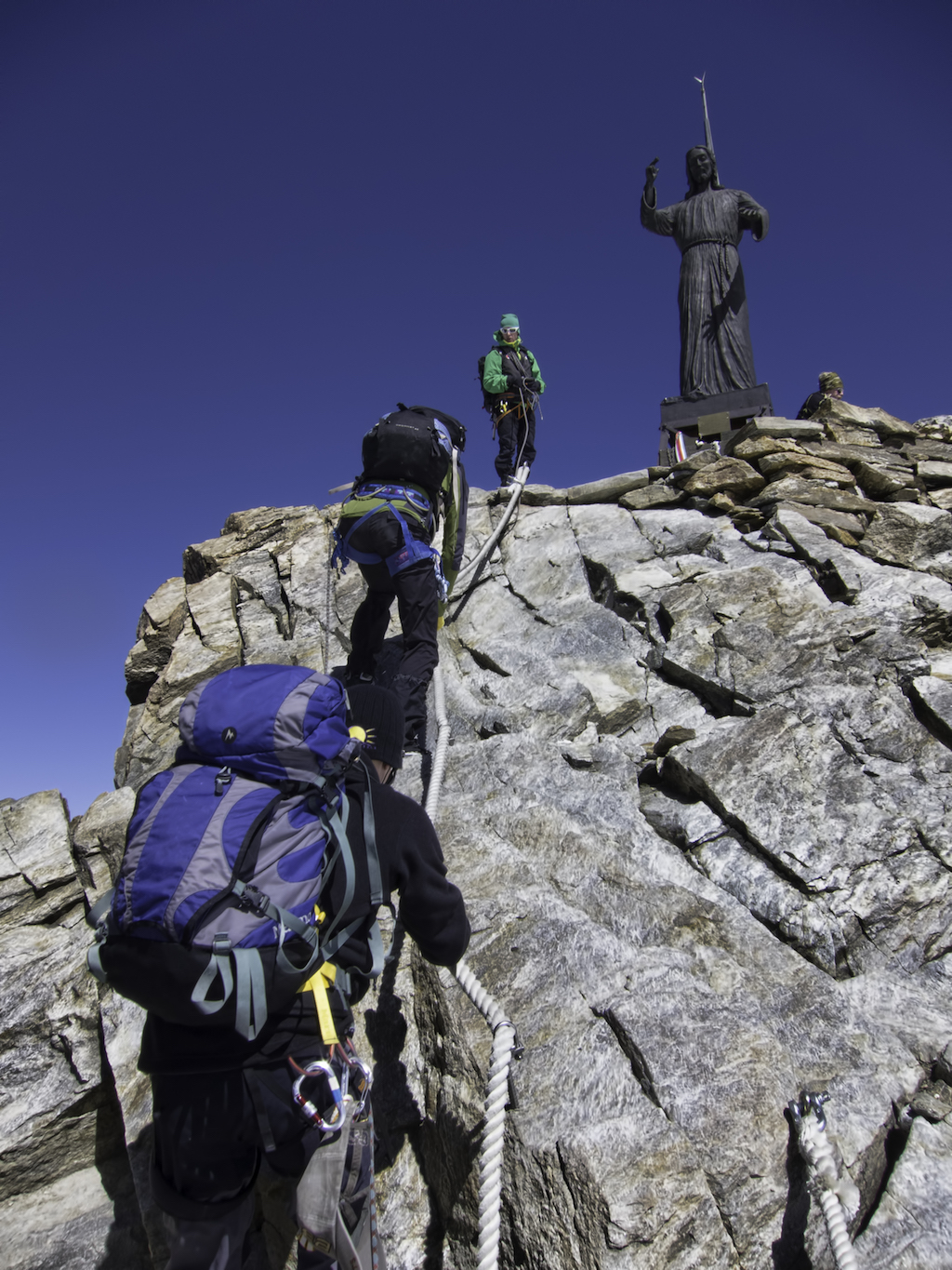
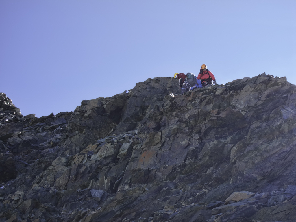
Balmenhorn is our fourth summit: a short, rocky step with a fixed rope takes us to the top with its massive statue of Jesus. We stop for a sandwich and a chat in the tiny mountain shelter.
There’s still time to shoot up Schwarzhorn before we head down to our next hut. Following Tom on the short summit ridge, I find myself hopping rather nonchalantly over a gap between two rocks; the crampons’ front four points are my only contact with the earth. I cast a quick glance through the gap, and it falls 2,500 metres to the bottom of the valley. My right hand holds the ice axe, the left just smears on the vertical rock face. I turn towards the Swede. “Tom, did I tell you that I haven’t really got a head for heights?”
A ski touring pair slowly make their way alongside us towards Pyramide Vincent’s top. It seems a very slow way to ascend, but they’re down at the hut before we take our summit picture. I look back at the Naso. From here, even the traverse looks incredibly steep and exposed. I shall therefore rectify my previous statement: our pitches on the Naso were definitely a climb on vertical ice – and yes, thanks, I’m feeling quite a mountaineer now.
“Look, another pair with the invisible rope.” Tom nods towards an unroped couple on the Rosa highway. He is clearly unimpressed. Indeed, even in perfect conditions we still find a few hidden crevasses: all it takes is one unlucky step.
Nine hours after leaving the Sella hut we are all around a table at the Gnifetti hut for the daily routine of beer, chat, sleep and dinner (not all at once).
I spend an uneasy night dreaming confusedly of a rhino with the flu locked inside a sawmill; when the alarm concert begins at 4am I automatically sit up and proceed to put on whatever I can grab that feels like clothing. I’m lucky the duvet cover doesn’t fit. Everyone else in the dorm is doing the same, and there is a bit of commotion as we all leave with our rucksacks on. At least, I assume this is mine, I haven’t quite opened my eyes yet.
I do open them at breakfast when I hear John say he’s had the best night of the trip. The look in Chad’s eyes tells me we both know who did all the snoring.
It’s still dark outside, and hordes of people are scattered donning their boots, ropes and crampons. Metal spikes fly literally everywhere – these must be the most dangerous moments of an alpine expedition.
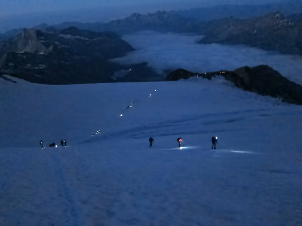
Safely out of the spikes whirlwind, we set off on the Rosa highway again: four dots of light in a long line of headtorches that wind their way on the glacier in the final hours of the night. We stop for a short rest at the Col de Lys. Lyskam’s long, snowy ridge is painted gold in the early morning light. The Matterhorn appears behind it, Mont Blanc is pink in the distance.
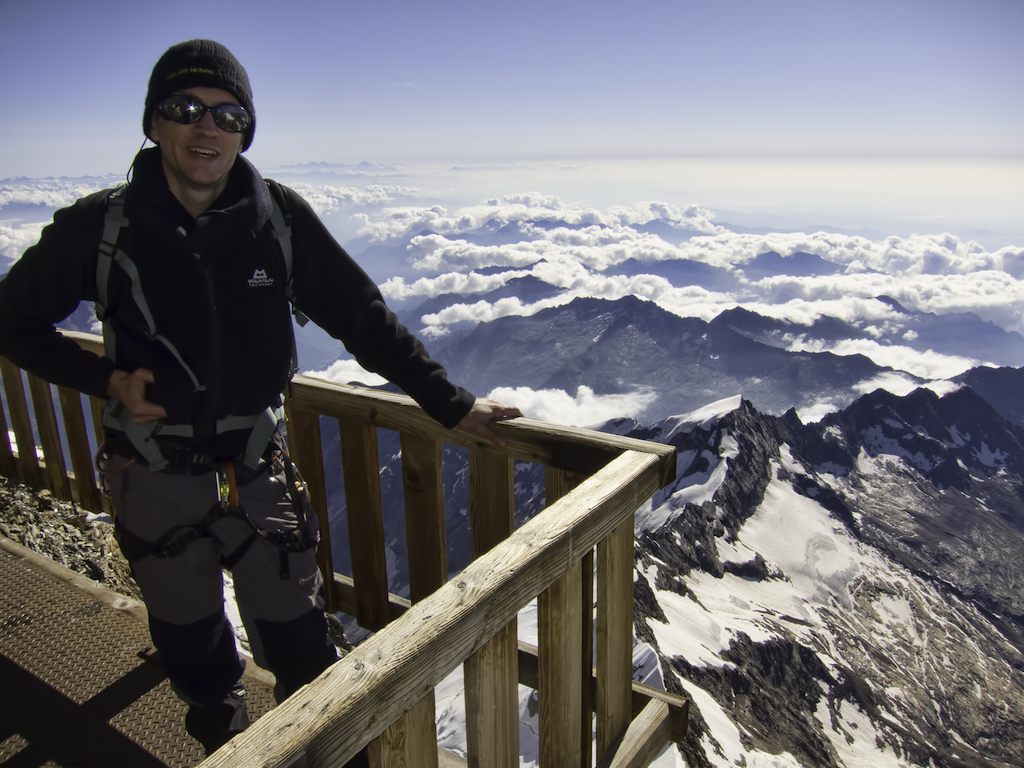
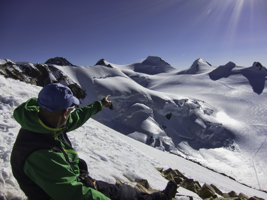
We move on, up and down Ludgwigshöhe, then on Parrotspitze’s ‘funky’ ridge as Tom calls it, whatever that means. Capanna Margherita, the highest hut in the Alps, will be our high-profile lunch stop. The hut has no right to be on a crazy rock spike between the glacier and an endless vertical drop over the Italian valleys. But from our table inside we enjoy a spectacular view of the Matterhorn. From above.
“So, OK, I’ve done the maths,” I ceremoniously announce – the moment feels right for a little celebration. “With the next peak we’ll have climbed 11 summits, and a total height of exactly 47,269m.”
I look around me with a big grin. “I’m not really sure you can do that…” starts Chad. But John steps in, “Hold on, hey, I like the concept. We’ve topped almost 50,000 metres!” Tom stares at us in disbelief.
Then we get going again – there’s no standing still on this trip. Zumsteinspitze is our last and highest summit before the long way down to the Monte Rosa hut and Zermatt.
Tom says it will be just a couple of hours, so we set off in high spirits down the Gorner Glacier, an immense bowl of snow surrounded left and right by scoured rock. The snow turns wet and sloshy under the blazing midday sun and crevasses open up –some we see, some we don’t. Stay alert, keep the rope tight, watch your feet. I take a peek down one as we jump across. Man, is it deep.
There’s a thunder. An avalanche, a rockfall? We all stop and turn around. I can’t see where it came from; it must have been a long way away, but it’s a stark reminder that we are not welcome here.
Tom lied. It takes two thirds of an eternity – at least – before we eventually step on the moraine and out of the glacier. Away go harnesses, axes, crampons, ropes. As we approach the Monte Rosa hut, five days since we left the Klein Matterhorn tunnel, we see the first blades of grass.
Let’s go: How to do the Monte Rosa Traverse
The Monte Rosa massif is a classic alpine destination on the Swiss/Italian border, popular for its ease of access and the (relatively) simple glaciers and summit routes (although you can easily find some insanely difficult climbs too).
With the abundance of high and low-level paths, views of the iconic Matterhorn, the highest, and possibly the most spectacular, hut in the Alps, and the prospect of gaining experience towards more demanding expeditions, it’s hard to find a reason not to go.
How to get to the Monte Rosa Massif
Our tour was organised as a round trip from Zermatt, starting on the Klein Matterhorn cable car and returning by the Gornergrat cog railway. Zermatt is well connected by train to Visp, Brig and from there the airports of Bern, Zurich and Basel: check www.mgbahn.ch for info and timetables. It is a car-free village, so if you are driving you’ll have to leave your car at Täsch and get a taxi.
It is also possible to start from Cervinia on the Italian side, with the Plateau Rosa cable car. You can get to Cervinia by car on the A5 Torino-Aosta motorway, or fly to Turin or Milan Malpensa and use a connecting coach service (www.savda.it).
The intermediate huts on the Italian side are typically reached from the valley heads with fairly long walk-ins or with lifts (check operating times), sometimes with the option of stopping at lower-level huts along the route. While these are also possible approaches, you will generally require your own transport and additional planning.
When to traverse the Monte Rosa Massif
Mid June to mid September is the season for summer mountaineering and glacier trekking in the Alps, and even then with due consideration of the condition of crevasses and the risk of avalanches at the time of the visit.
Route options
We followed a classic hut-to-hut traverse, a variant of what is apparently called the Spaghetti Tour (because of all the spaghetti you eat in mountain huts); the basic itinerary can be altered to include harder climbs, additional peaks or different entry or exit points.
Shorter trips can be made to individual summits, such as the ascent of Breithorn, considered the easiest 4,000er, or the Castor and Pollux pair from the Klein Matterhorn or the Ayas hut. Lyskam is another classic, although its long and exposed ridge makes for a more committing traverse. The Capanna Margherita hut is a worthy destination in its own, and if you just stay on the Monte Rosa highway the route is graded at F.
Finally, our trip didn’t attempt Dufour-spitze, the main summit of Monte Rosa. It’s climbed either from the Italian side with a technical (AD+) but relatively short route from the Margherita hut (or from Gnifetti with a crazy early start), or via the easier (PD+) but much longer ascent from the Monte Rosa hut.
Equipment
On a sunny summer day glaciers can be incredibly warm, and you’ll probably find yourself sweating in short sleeves: good sun protection and UV-proof sunglasses are therefore vital.
Having said that, the weather can turn at any time and summer thunderstorms are frequent in the Alps – one of the reasons to start early in the morning. This means that you’ll have to find room in your rucksack for good warm layers (including hats and gloves) and waterproofs.
You will also need good boots and gaiters, your ice axe and crampons (ideally a B2-C2 combination) and enough rope for the whole party. Many people use a single pole in combination with the axe, while others carry two and swap them with the axe depending on the terrain.
All this, plus extra clothes, emergency kit and other accessories should comfortably fit in a daysack. Eating and sleeping in huts makes heavy, bulky rucksacks unnecessary. Safety in the Alps also begins with the ability to move quickly, which is another good reason to keep your daysack as light as possible.
Health and safety
We followed the technically simpler summit routes, none of which are graded higher than PD+, and traversed relatively straightforward glaciers mostly in good conditions. Even so, these are alpine climbs not trekking routes.
They require at least a basic knowledge of roped movement with ice-axe and crampons, confidence navigating in a mountain environment and a minimum practice with climbing and crevasse rescue. If you are unsure of your skills, hire a guide, or take some courses beforehand.
Hypothermia can be avoided with proper equipment and some caution with the weather – be prepared to spend a lot of time in a hut or a bivouac if needed. At the other extreme, remember to protect yourself against sunburn and stock up with water at every hut: even with all that snow around, this is a very dry environment and dehydration is a risk.
Almost the entire route is above 3,500m, and if you start from the Klein Matterhorn you will find yourself over 3,800m directly from the valley floor: acute mountain sickness is therefore a possibility, and prior acclimatisation is recommended.
Leave no trace
Glaciers are like gigantic freezers: anything thrown there, even if theoretically biodegradable, will remain for years. With so many people walking up and down the Monte Rosa highway it was a surprise to find it clean and free of any trace other than crampon marks. Let’s help keep it that way.
Operators
We went on ISM’s Monte Rosa Chain expedition. The company also offers mountaineering tours for different skill levels, with the option of basic to advanced alpine skills tuition. Other companies offering a similar trip include KE Adventure Travel; Jagged Globe and Odyssee Montagne. Or you can organise your own expedition and contact local alpine guides in the area directly: from Zermatt to Cervinia, Gressoney, Alagna, Macugnaga or any of the neighbouring and not-so-neighbouring villages.