


Hiking Wainwright’s Coast to Coast in a weekend
50 years ago, a bloke put his boots on, put his pipe in his pocket, swung open his front door (it might have been the back door – records are hazy) and went for a walk. Decades later, it was voted as the second-best walk in the world, beating out competition from the likes of the trek to Everest Base Camp, the Tour du Mont Blanc, and the Inca Trail to Machu Picchu. Mind you, I suspect there was a trace of bias from the voting panel over at Country Walking magazine.
The man, of course, was Alfred Wainwright, and he called this route the Coast to Coast Walk. Since his book on the walk was published in 1973, he’s inspired countless people from around the world to take to their feet and explore the great British countryside.
Ironically, as he stated in the book, Wainwright sought to “encourage in others the ambition to devise with the aid of maps their own cross-country marathons and not be merely followers of other people’s routes: there is no end to the possibilities for originality and initiative.” But when you’ve devised the walking equivalent of Moonlight Sonata, you can’t expect people not to enjoy following your route.
A national trail
In fact, it’s proven so popular and become so beloved that it gained National Trail status in 2022, a designation which has secured £5.6 million in funding for the walk. This is allocated for upgrades to the path infrastructure, waymarking, accessibility improvements, legalising rights of way, and promoting the walk.
The proposed official opening of the Coast to Coast as a National Trail is slated to take place this year, although as a government project, we can expect it to open sometime in 2032, £15 million over budget, with the final section through the North York Moors axed.
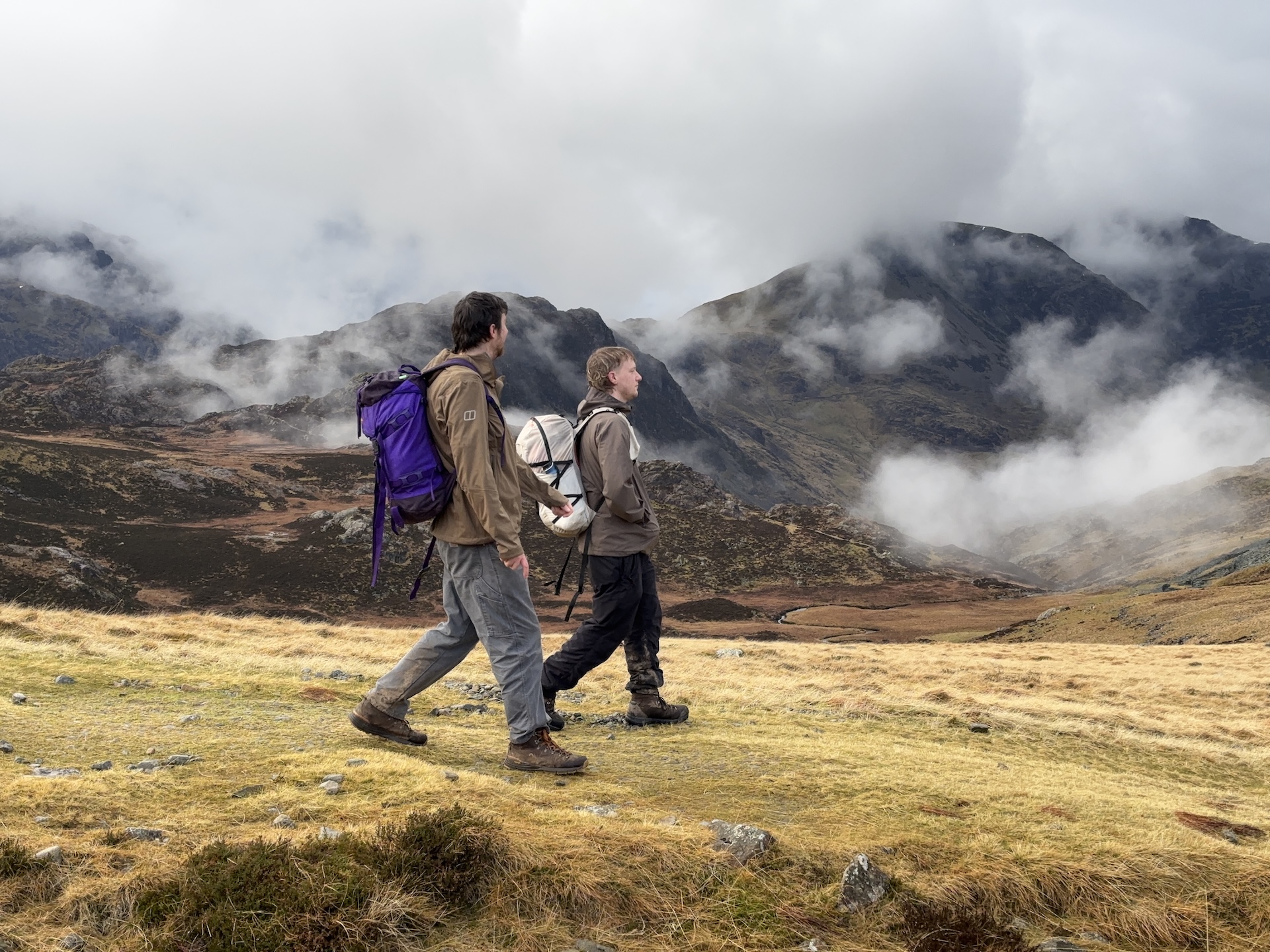
Cost projections and timelines aside, in recognition of the Coast to Coast gaining National Trail status and to check out the work that was being done, Ross and I thought we’d mosey on up to St Bees to walk the Coast to Coast ourselves. In keeping with our Wild Weekends series, we decided to walk just the first two days of the ordinarily two-week itinerary. Starting from St Bees, we’d head west into the heart of the Lake District and end up in the pretty village of Rosthwaite.
Shore drift
The first part of our trip consisted of shuffling from our destination to our start point. As we both rode up on motorbikes, we met in Rosthwaite after work, left one bike and two helmets, and then rode two-up over to St Bees.
Our digs for the night was the Seacote Hotel; one of those welcoming old labyrinthian hotels with lashings of carpet and wallpaper, and a seasoned barman holding down the fort. We toasted the start of the walk with a fitting pint of Wainwright Gold and hit the hay with the sound of the Irish Sea ruminating beyond the window.
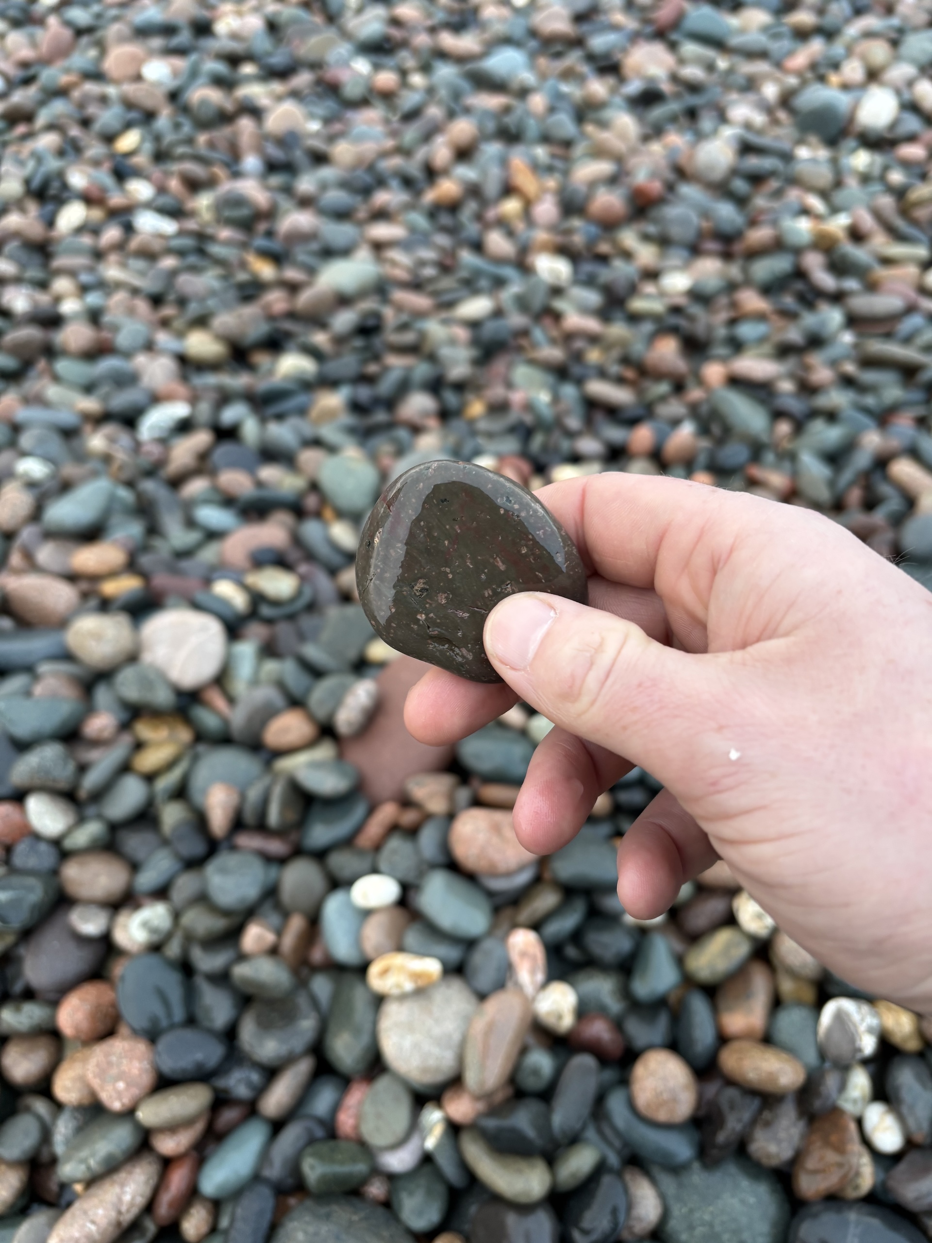
We were treated to a slap-up breakfast the next morning and managed to sequester some sausages and a few slices of bread to make some sarnies for the road. Lunch sorted, we left the hotel and walked down to the beach to officially start the Coast to Coast. As many have done before us, we selected a pebble from the shore, which is then carried across the country and deposited on the beach at Robin Hood’s Bay.
If the walk becomes popular enough, St Bees could have a serious shore erosion problem on its hands in a few decades.
An ornithologist’s paradise
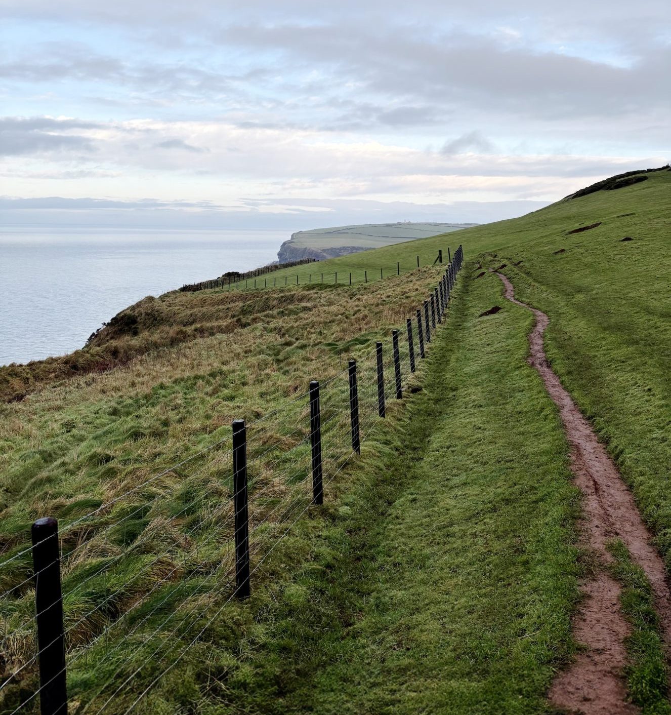
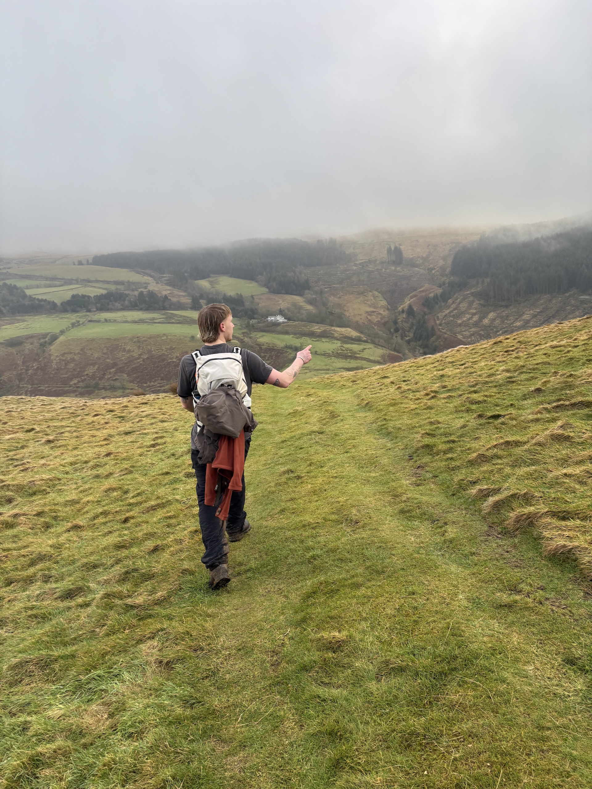
The first part of the Coast to Coast is a real stunner. You immediately climb up to the top of the cliffs, with a sweeping view of St Bees’ Bay behind you and views across to the Isle of Man on a clear day. The sun was still wallowing somewhere in the bank of clouds on the horizon, but the sky above us was clear and the air was eerie in its stillness.
It’s an ornithologist’s dream, with St Bees Head boasting colonies of puffins, fulmars, razorbills, peregrine falcons, and hosts the only breeding ground for black guillemot in England. The ground itself is spectacular, as well: cliffs of red sandstone with outcrops sporting beards of lichen and guano.
We continue around St Bees Head, past the lighthouse and a quarry that’s supplied stone for the Liverpool Cathedral along with buildings as far afield as Hong Kong. As the route turns inland, there’s an unremarkable section across farmland, under a railway, and on through the villages of Moor Row and Cleator.
The ascent of Dent
The first real climb of the walk begins once you leave Cleator, with the 352m-high Dent rising ahead. At the base of the hill, we perched ourselves on a slab of rock just past a gate that read ‘Danger Bull’ and swiftly ate some biscuits and rehydrated before beginning the ascent.
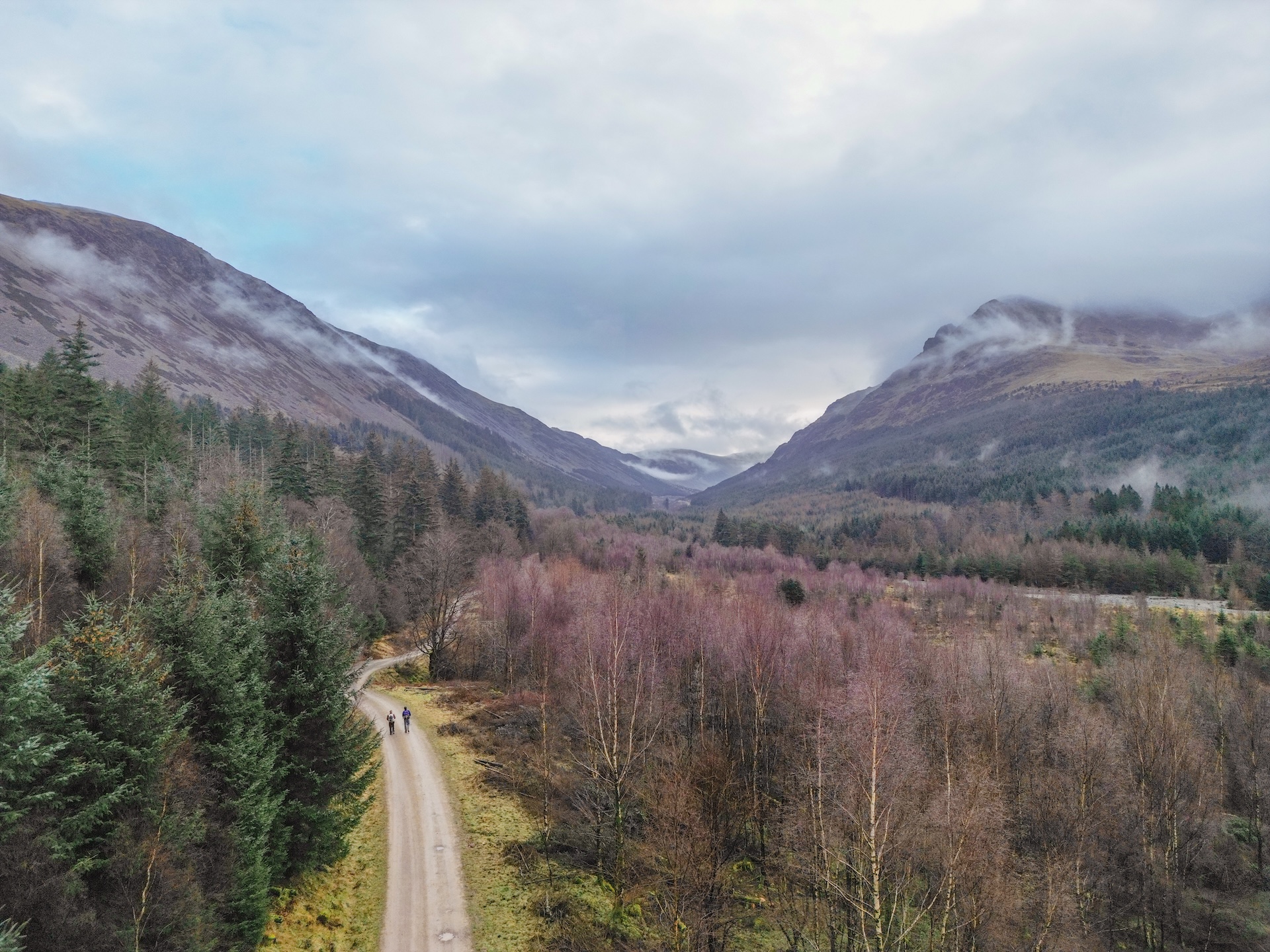
The climb begins on a forestry track before diverting onto a boggy path through the plantation, fallen branches frequent but surmountable obstacles. Emerging from the woods, we begun he slog up the steep slope of Dent, the sun breaking through the clouds to illuminate the nuclear facility at Sellafield a few miles in the distance.
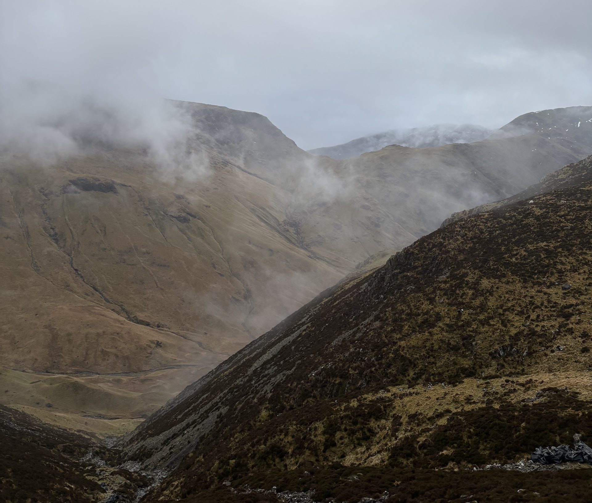
As always, the climb was worth it because the other side of Dent revealed a deep valley and western Lakeland fells idling in the hazy extent of our visibility.
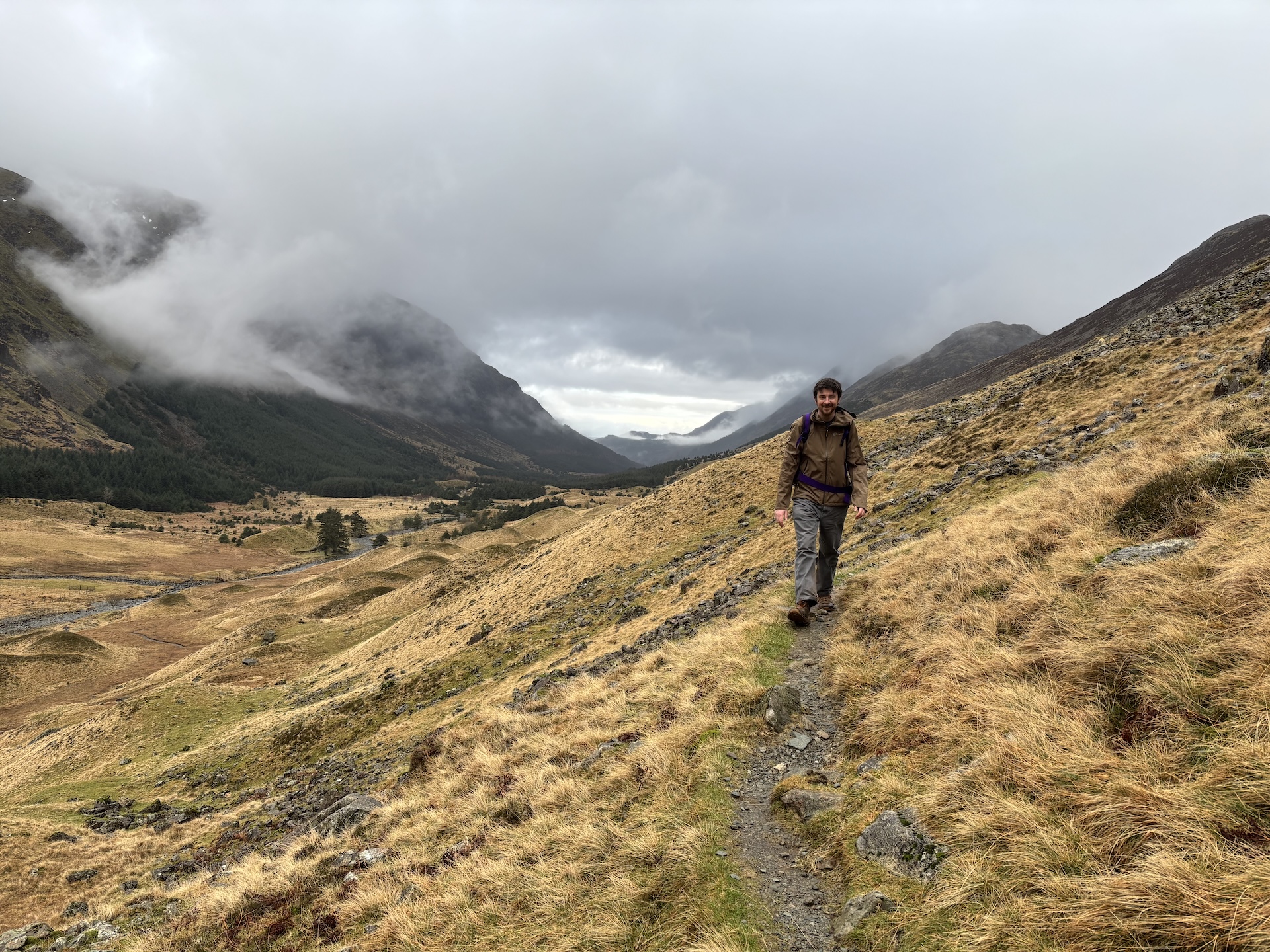
As luck would have it, we could admire this vista from the perch of a perfectly sculpted bench, before descending a near-vertical slope into the valley. From here, it was an easy few miles of walking on well-made paths into the village of Ennerdale Bridge.
A walk in the dark
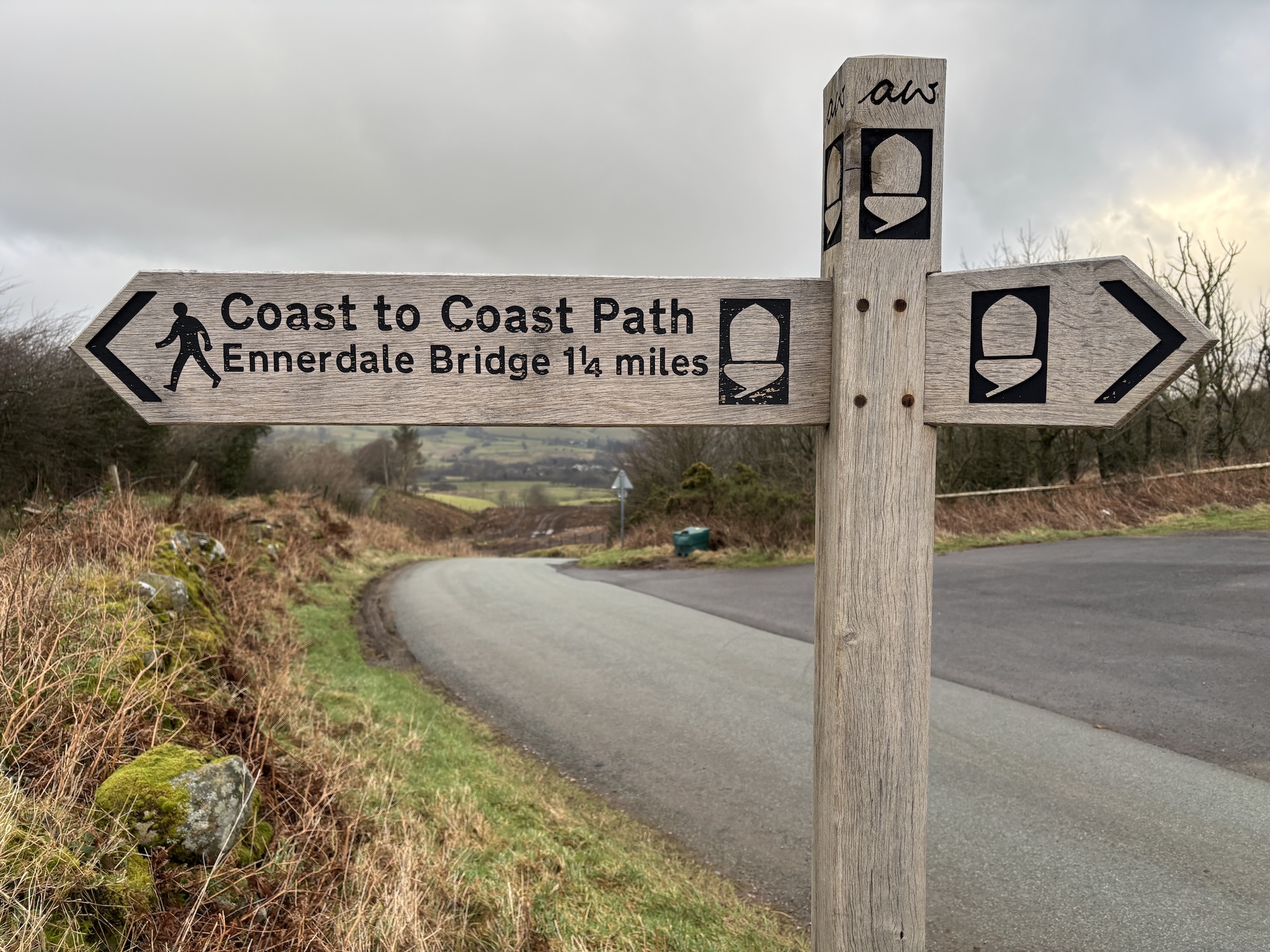
The village has a community-run cafe called The Gather, which is open until 4pm every day. It sells drinks and food and has a selection of essentials for walkers and cyclists such as plasters and inner tubes – but not much in the way of groceries. Wainwright’s itinerary suggests stopping here the first day, and there’s plenty of accommodation options.
However, we wanted to stay in the Ennerdale valley, so we booked ourselves in at the Low Gillerthwaite Field Centre hostel, another six miles from Ennerdale Bridge. Before we left, we filled our bellies with superb fare and washed our food down with a local ale at the Fox and Hounds to steel ourselves for our walk through the approaching night.
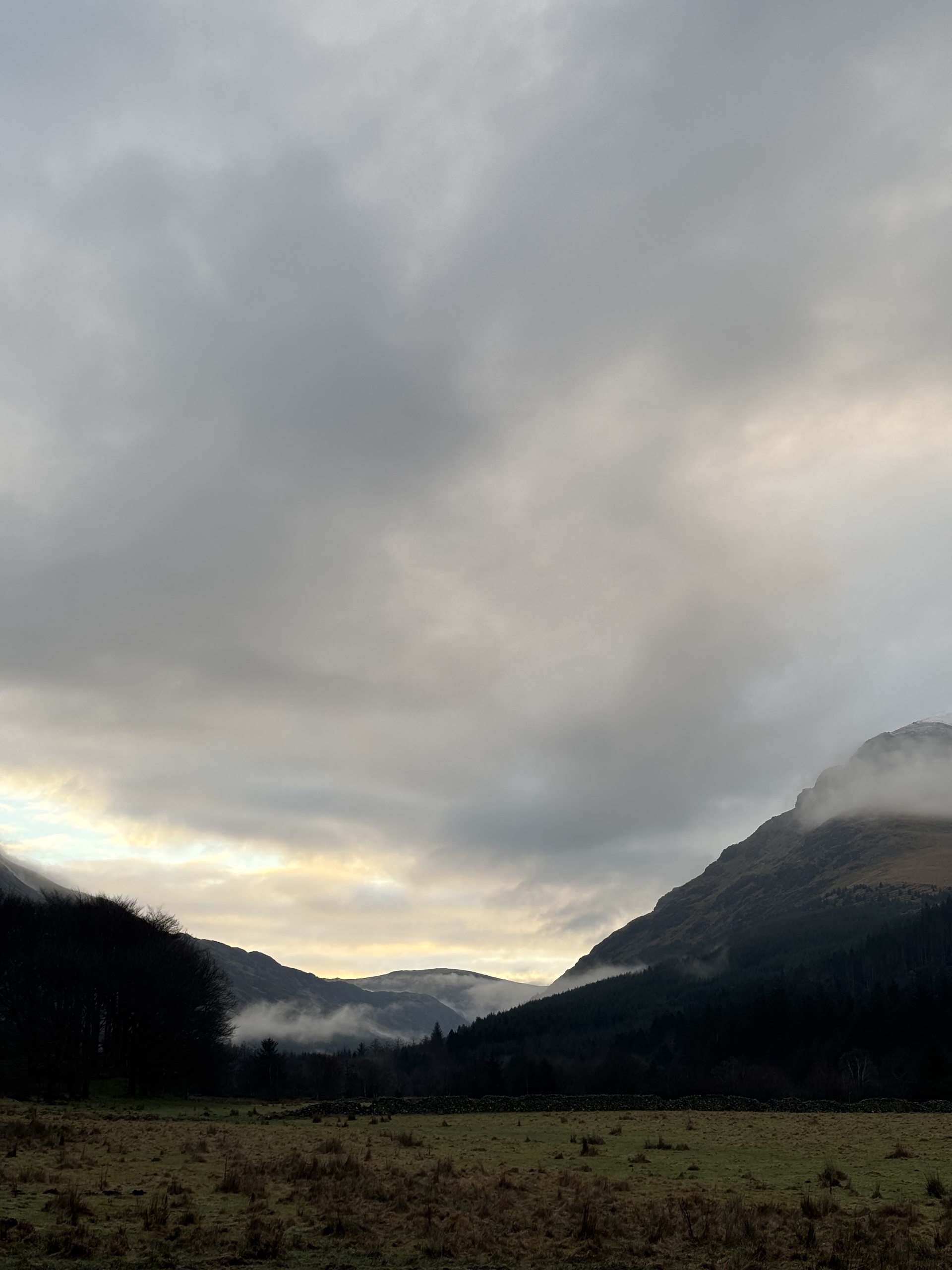
Glittering diamonds of raindrops fell about us as our headtorches cut beams through the enveloping darkness. Naturally, as soon as we left the warmth of the coal fire in the pub, it began to rain.
But the walking was easy, and although we could only just make out the immense blackness of Ennerdale Water and the towering fells, it was clear from the fresh air and silence that we were in a beautiful part of the world.
Workers had been busy on this section of the Coast to Coast, with bridges being lowered and steps removed for accessibility, and the path was well-graded with gravel. We could see signage being installed as well, with waymarkers bearing the National Trail acorn symbol, the words ‘Coast to Coast’, and a signed ‘A.W’ for the man behind it.
An armchair by the fire and a good book to read
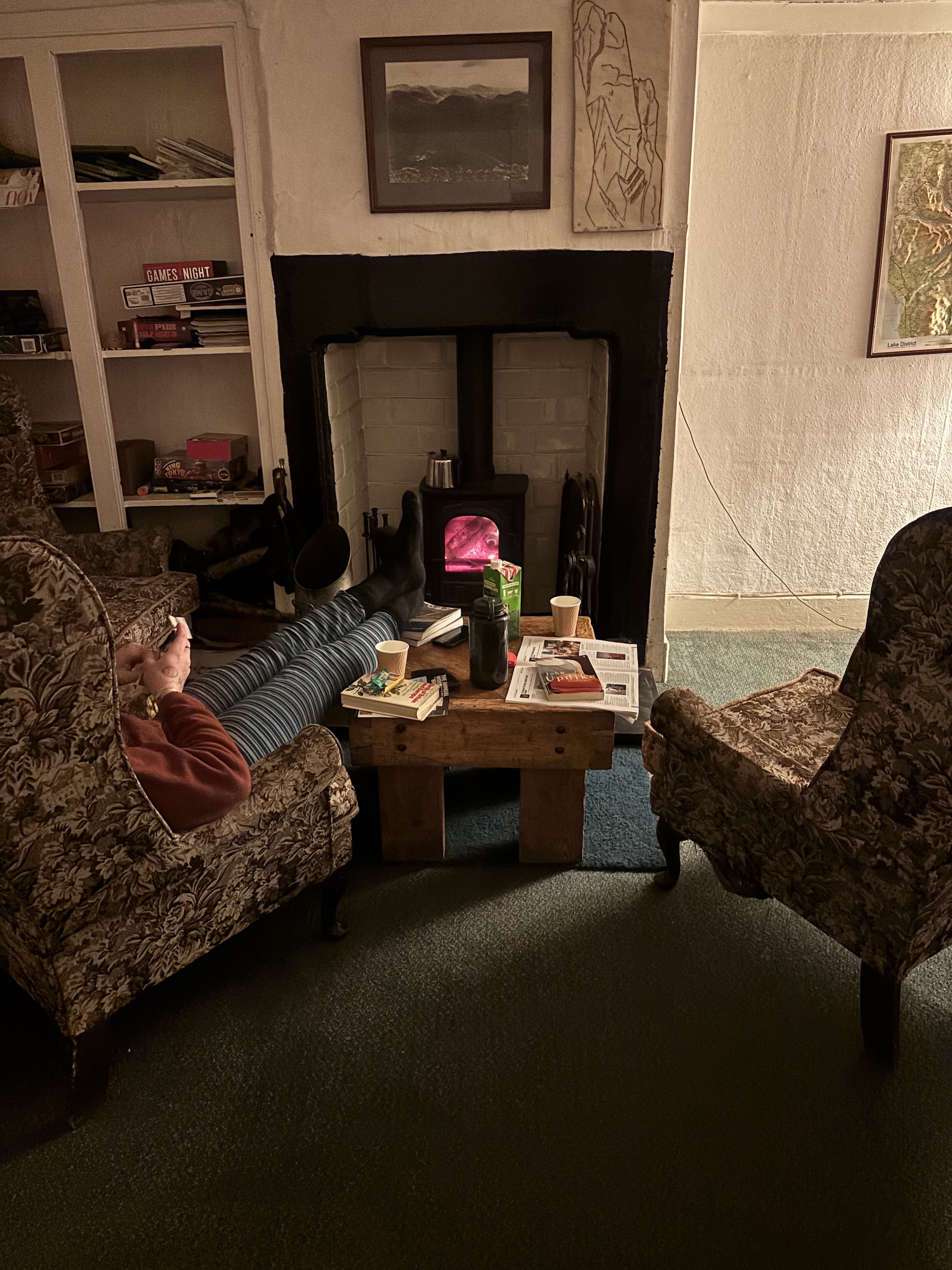
The six miles to the hostel passed underfoot easily even as the day’s odometer ticked over 20 miles. Walking into the farmyard, Ellen the warden greeted us warmly and showed us around the hostel, with an industrial kitchen and bunks enough for 40. She offered up some kindling for the log burner and some milk for a cuppa, and we tucked ourselves into the cosy living room, lit the fire, and sunk into a pair of excellent armchairs to read our books.
It was just the right amount of rustic with the luxuries of a hot shower, flushing loos, and a gas hob to make for a very comfortable stay. And although we could have had an entire room each to ourselves, we ended up kipping in the living room by the glow of the fireplace.
The valley is revealed
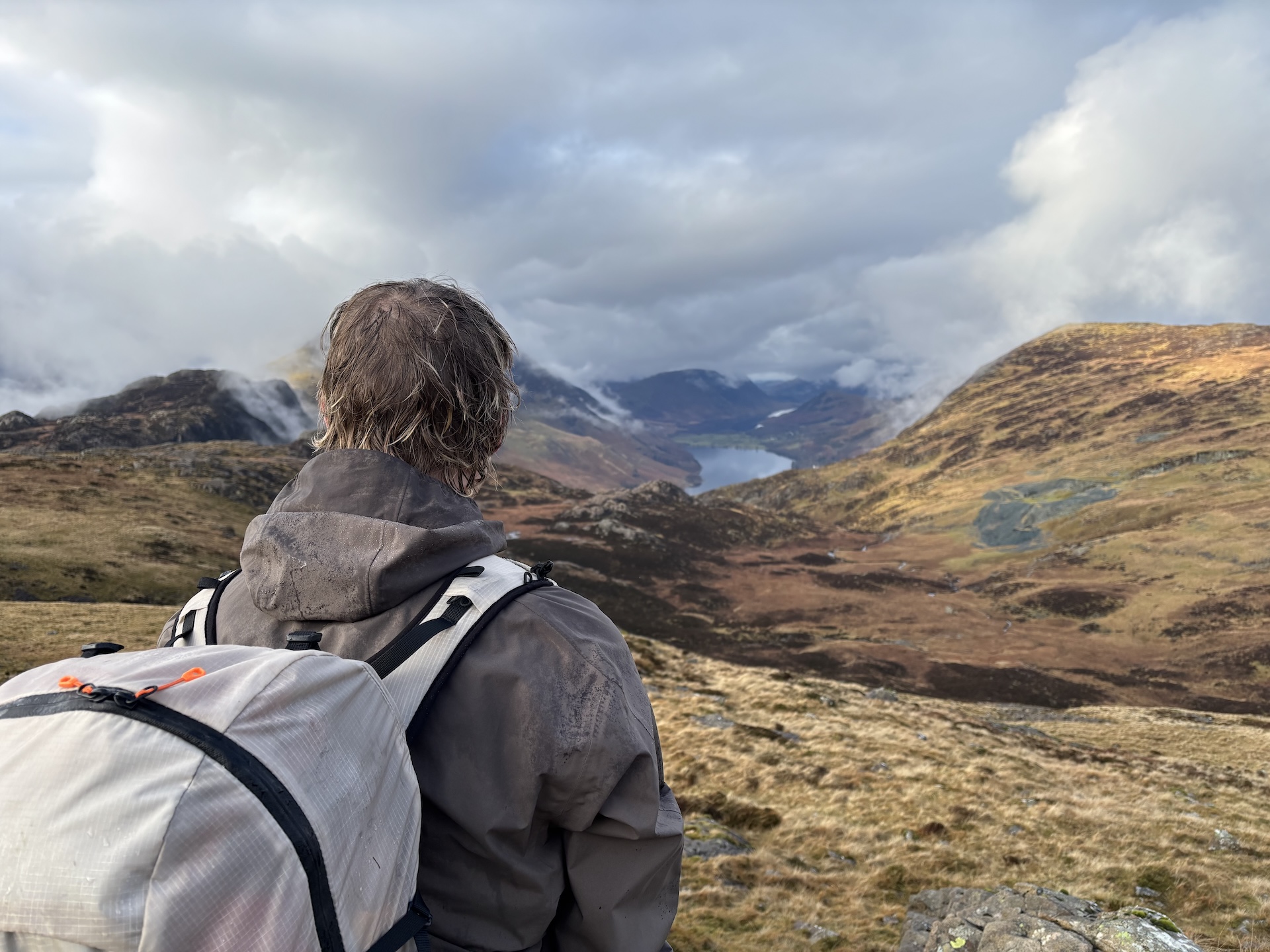
When the sun rose the next morning, we could finally see our surroundings. With the scree slopes of High Stile and High Crag to the north, the jutting chin of Pillar Rock to the south, and the mist-shrouded forest blanketing the valley, Ennerdale is a wondrous place to wake up. We drank our coffee, had a meagre ration of porridge, shared a croissant, and set off for our second day.
The first few miles were easy, an undulating forestry road taking you almost to the end of the valley. This is where the Black Sail YHA is located, another stunning spot to stay or stop by if you get the chance.
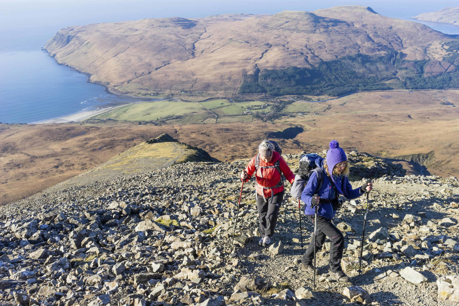
From here, the route climbs steadily up Seavy Knott, a steep but not too long ascent. For the most part, the path upwards is well-built, with stone steps making progress relatively easy. More work is being carried out here, with bags of stone that had been flown in by helicopter lying beside the trail, waiting to be laid in the path.
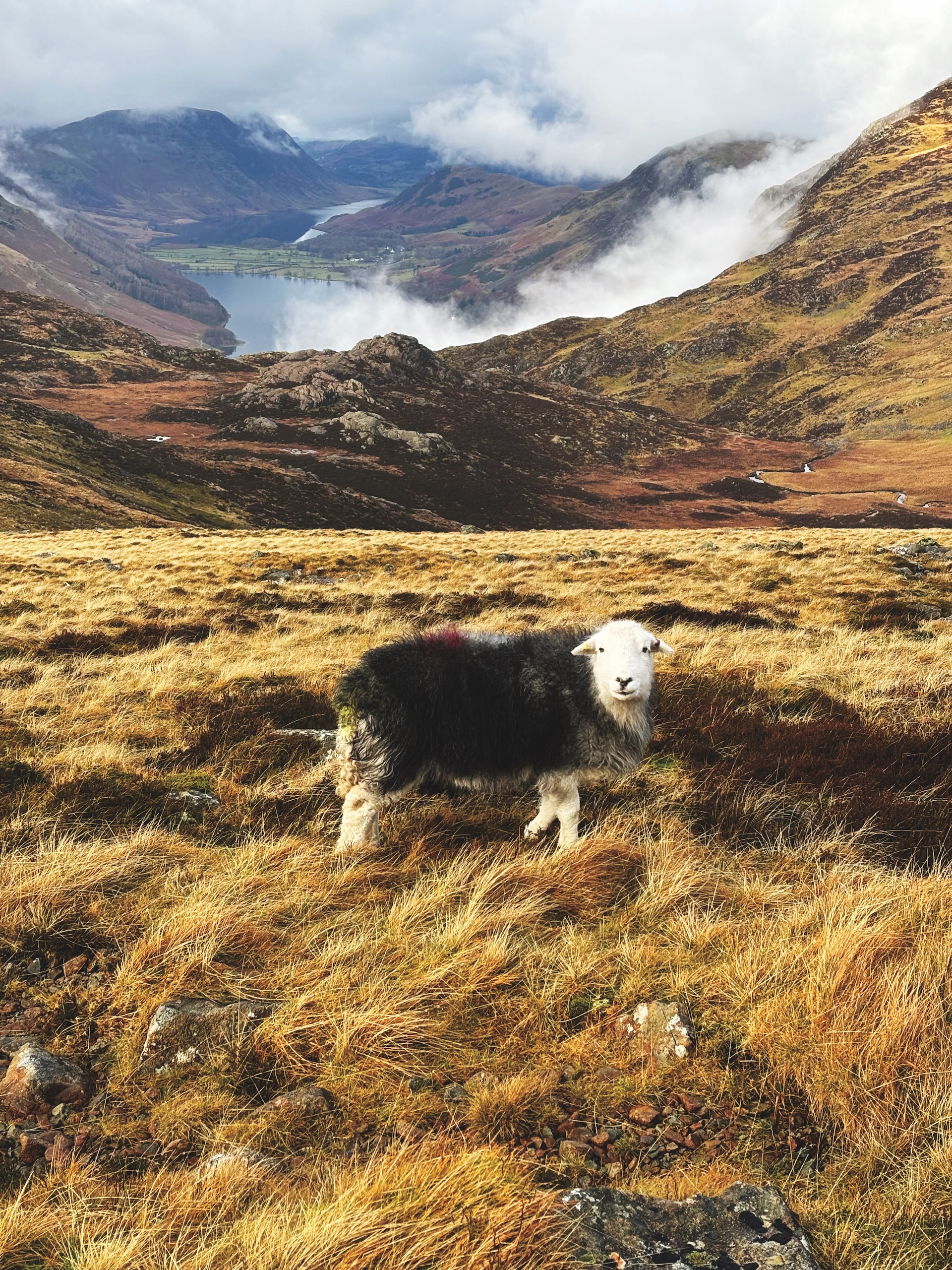
It didn’t take us too long before we reached the highest point of the trail for the day, and we were lucky enough to be up there without too much cloud cover. We could see back down Ennerdale, across Buttermere, and snow-capped fells in the distance. In summer, we’d likely be sharing the view with a dozen others. But in the middle of winter, we had the place to ourselves.
There’s something to be said for braving the cold and rain when you get moments like that.
All downhill from here
A quick climb down a dismantled tramway took us to Honister slate mine, and we dropped in for a coffee and a bap. Refuelled and ready for the final section, we followed the old toll road down, passing a worker who was rebuilding a culvert on the trail as part of the upgrade works. A few miles of cheerful walking through damp old woodland, and we found ourselves in Rosthwaite and the end of our walk.
Now that we’d had a taste for the Coast to Coast, we didn’t really want to tap out; we were only just getting warmed up. But over the last two days we’d rambled along rugged cliff tops, across rolling farmland, through remote valleys and lush woodland, and climbed mountains.
It was a greatest hits collection of walking in England, and as far as weekends go, it was bloody well spent. Nice one Wainwright.
How to do it
The National Trail version of the Coast to Coast is 197 miles, which crosses the Lake District, the Yorkshire Dales, and the North York Moors. It can be walked any time of year, but some accommodation options will be closed in winter, and you’ll need to be prepared for hazardous weather, especially in the Lakes.
There are places to stay and eat every day, but not buy groceries, so you’ll need to plan ahead if you want to cook food yourself.
To walk the section we walked, you’ll save yourself a lot of hassle if you can leave a vehicle at Rosthwaite and one at St Bees. Rosthwaite is poorly served by public transport, although you’d have a good chance at hitching a lift a few miles to Keswick, which has better transport links.
There’s also the option to book with a self-guided walking holiday group such as Contours Holidays (www.contours.co.uk), who will arrange accommodation, some meals, and luggage transfers.
Guides
You can find Wainwright’s original A Coast to Coast Walk: A Pictorial Guide second hand; there’s also a revised version available. Harvey publishes a single waterproof strip-map of the entire route, you can also get OS Explorer OL4, OL5, OL7, OL19, OL26, OL27, OL30, 302, 303 and 304 to cover the complete walk.
More information
Visit the National Trails website (www.nationaltrail.co.uk) to find more info on the walk and updates on the improvement works. You can also visit the Wainwright Society website (www.wainwright.org.uk) for more resources on the Coast to Coast and the man himself.


