

The world’s best hut-to-hut treks
About the Author: Billy Johnson

There’s something special about a hut-to-hut trek. It’s liberating. There’s no need to carry a tent, ration out your provisions, or faff around with pitching your tent every night. You can hike light, move fast, and settle into purpose-built accommodation each night with a hot meal and a roof above your head.
The roots of hut-to-hut trekking stretch back centuries. Many of Europe’s mountain huts were originally built as refuges for shepherds, traders, mountaineers, and early explorers. Safe havens in the high places. Today, the Alps alone are home to over 1,300 mountain huts, forming a vast web of trailside accommodation that makes multi-day trekking in mountainous landscapes more accessible than ever before.
Part of the appeal of hut-to-hut trekking lies in the variety. Some huts are simple shelters with shared dorms and one item on the menu. Others feel more like boutique hotels perched on the side of a mountain. But one thing is consistent no matter the type of hut you’re in: they add rhythm to the journey and become landmarks that offer rest, food, shelter, and a warm dose of local hospitality. Of course, you’ll still need fitness, stamina, and a head for heights to reach these places, but you won’t need to be self-sufficient or sleep in a snow hole.
From the flower-filled meadows of the French Alps to the ridgelines of Japan’s Northern Alps, these trails link together a chain of mountain refuges that make remote regions more accessible for those willing to put in the miles.
So, if you’re dreaming of big adventure without the worry of full-on logistics, this is where to start.
Swiss Whisky Trek

In the heart of eastern Switzerland, there’s a region where traditional mountain huts, alpine pastures, and panoramic trails meet an unexpected, but pleasant twist: whiskey. Welcome to the Appenzell Alps, home to Switzerland’s Whisky Trek, a hut-to-hut route that combines scenic Alpine hiking with tastings of locally aged single malts.
This isn’t the crowded Switzerland of tourist postcards either. The trails here are steep but quiet, winding through meadows strewn with wildflowers and the sound of cowbells. Along the way, you’ll stop at rustic huts, many offering private rooms, hot meals, and whisky tastings from the surrounding alpine distilleries. This hike isn’t just about ticking off the miles; it’s about the food, drink, and culture that’s shared along the trail.
The Trek
The Swiss Whisky Trek isn’t just a gimmick; it’s an expertly curated hut-to-hut route through the Appenzell region, with multiple itinerary options available ranging from relaxed to adventurous. Most treks begin in Wasserauen and loop through peaks and ridges like the Säntis massif, stopping at iconic huts including the Aescher Hut, one of Switzerland’s most photographed, that is perched precariously at the base of a 100m-high rock face.
The whole route spans 60-80 km, depending on the variation you choose, with some exposed sections in the higher regions featuring safety cables for you to hold onto (no technical gear is required). You’ll pass alpine lakes, panoramic ridgelines, and high pastures where cheese is still made by hand.
Each hut on the whiskey trek stores a unique bottle of Appenzeller malt whisky, ageing it at altitude. It’ll be your job to taste each one and mark them off on your tasting passport. It’s hiking with a fun and delicious twist.
How to do it
Alpenventures UNGUIDED offers a range of Whisky Trek itineraries, from full eight-day tours with high alpine sections, to relaxed six-day routes with luggage transfer and lower mileage. Their self-guided format includes route planning, bookings, digital maps, and full logistics, leaving you free to hike at your pace and savour every sip.
The region is accessible from Zurich and trails are well marked.
Fast Facts
Start/Finish: Wasserauen loop
Distance: 60-80km
Time to hike: 6-8 days
Best time to go: Late June – September
Highlights: Aescher Hut, Appenzell whiskey tastings, Alpine views
Ideal for: Experienced hiker seeking scenic trails with a unique twist
Kamikōchi-Yari-Hotake Traverse, Japan

The Kamikōchi-Yari-Hotaka Traverse is a dramatic high-mountain route in the heart of the Japanese Alps and is considered to be the crown jewel of trekking in Japan. Connecting the lush Kamikōchi Valley with the rugged Hotaka Range and iconic spear-like summit of Mount Yari (3,180m), the route delivers real altitude, serious views, and a sense of adventure that’s far removed from Japan’s more serene trails like the Nakasendo Trail.
It’s a true mountain route across narrow ridgelines, steep gullies, and dramatic high mountain huts that cling to the spine of the northern Alps. Think of it as Japan’s Haute Route, only quieter, steeper, and more otherworldly.
The Trek
Most hikers begin in Kamikōchi, a beautifully forested valley that’s reachable by shuttle bus from Matsumoto. From there, the route climbs steadily alongside the Azusa River to Yari-ga-take, one of Japan’s most beloved peaks that’s often described as the ‘Matterhorn of Japan’.
The next section is the guts of the traverse, a thrilling high-level ridgeline trail that links Mount Yari to the peaks of Okuhotaka-dake (Japan’s third highest mountain) and Karasawa-dake, threading a knife-edge path across dramatic, rocky terrain. Rope-assisted scrambles, steel ladders, and big exposure make this one for confident trekkers who are comfortable with exposure, and the payoffs are enormous. You’ll get sunrise views above the cloud line, distant glimpses of Mount Fuki, and mountain huts with incredible panoramas.
Most itineraries take three to six days, staying in a network of full-service huts perched high in the range. Expect delicious Japanese meals, futons in communal bunk rooms, and a nightly buzz of camaraderie from local hikers who trek the route each summer.
How to do it
The season runs from mid-July to late September, when the snow has cleared from the passes and the huts are open. While the trail doesn’t require technical mountaineering gear in the summer, sure-footedness, good weather judgement, and alpine experience are essential, especially across the razor-edged Daikiretto, which links Yari and Hotaka.
You can hike it independently or with a local guide, and while English signage is limited, the route is popular with domestic hikers and well supported by staffed huts.
Fast Facts
Start/Finish: Kamikōchi to Kamikōchi
Distance: 40-50km
Time to hike: 3-6 days
Best time to go: Mid-July – late September
Highlights: Mount Yari, Daikiretto Ridge, sunrise cloud inversions
Ideal for: Experienced alpine trekkers looking for a challenge
Tour des Combins, Switzerland and Italy
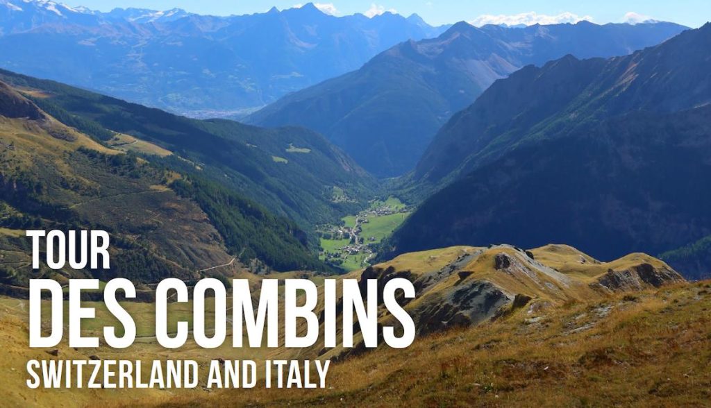
Tucked between the popular Tour du Mont Blanc and the quieter valleys of the Swiss canton of Valais, the Tour des Combins is a hut-to-hut experience that offers solitude, alpine drama, and old-world charm. Circling the Grand Combin massif (which reaches a heady height of 4,314m), this route offers classic alpine trekking without the crowds, stunning glacier views, and cosy mountain huts where you can get a good night’s sleep in peace.
The trail traces an ancient route once used by traders crossing the Grand St. Bernard Pass and today offers a more low-key alternative to the big-name treks of the Alps. As you go, you’ll get up close to giant glaciers, high mountain meadows, and get to taste two alpine cultures: Swiss and Italian.
The Trek
Most hikers begin in Bourg-Saint-Pierre (in Switzerland) or Valpelline (Italy), taking between six and eight days to complete the loop. The trail stays high for much of the journey, often above 2,000m, with plenty of ascents and descents, and it’s a route for hikers with decent fitness and a sense of adventure.
The huts along the way are authentic and welcoming, offering bunkhouse-style shared rooms or private accommodation if desired. One of the highlights of the trek is a night at Cabane Brunet or Refuge Champillon, both of which offer comfortable accommodation and stunning views. Along the route, keep an eye out for marmots, ibex, and eagles soaring high above.
Unlike its more famous neighbour, the Tour du Mont Blanc, the Tour des Combins rarely dips into towns. Instead, it’s a proper backcountry experience, being wilder and more remote.
How to do it
Alpenventures UNGUIDED offers a self-guided Tour des Combins itinerary with full support: route maps, hut bookings, and expert logistical planning. You choose your pace and dates, they’ll handle the rest. Their itinerary includes the best huts on the circuit and options to extend or shorten the trek to your liking.
For fit and experienced hikers looking to escape the crowds, this is one of Europe’s best hut-to-hut hikes.
Fast Facts
Start/Finish: Bourg – Saint-Pierre
Distance: 85km
Time to hike: 6-8 days
Best time to go: Mid-July – September
Highlights: Perfect views of Grand Combin, historic passes, quiet trails
Ideal for: Experienced hikers wanting a more remote alpine trek
Tour of the Vanoise, France
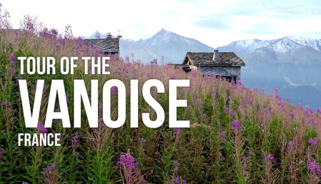
ust south of Mont Blanc, hugging the border with Italy, lies the Vanoise National Park, a quieter, gentler region of the Alps that’s perfect for hut-to-hut trekking without the crowds and dramatic trails of the more famous routes.
The Tour of the Vanoise loops through green alpine meadows, beneath rugged peaks, and along well-trodden paths where you’re more likely to bump into a marmot than another person. It’s classic alpine trekking at a more relaxed pace, with less daily ascent and descent, making it ideal if you want a rewarding adventure without terrain that’s going to punish you.
The Trek
Most itineraries take six-seven days, following a loop from Pralognan-la-Vanoise, a charming mountain town that’s night and day compared to the hustle and bustle of Chamonix. The trail rarely drops into the deep valleys, instead keeping you high in the hills with constant mountain views.
Along the way, you’ll stay in welcoming huts, or refuges as they’re known in France, each with its own charm and delicious food on offer. You’ll also cross high passes, wander through glacier-carved valleys, and watch the sun set over jagged ridgelines with nothing but the sound of cowbells and a gentle breeze in the air.
Unlike more challenging alpine treks, the Vanoise offers moderate elevation gain and well-graded paths. It’s perfect for hikers managing knee pain or simply seeking a less intense experience. And while the trails are easier on the legs, the scenery never feels anything less than spectacular.
How to do it
Alpenventures UNGUIDED offers a self-guided itinerary of the Tour of the Vanoise with optional luggage transfers, custom route planning, and local logistics support. They’ll handle your booking and provide trail navigation tools, so all you need to do is hike between huts and enjoy the view.
This is the perfect introduction to multi-day trekking in the Alps, or a great option for experienced hikers who want something relaxed yet spectacular.
Fast Facts
Start/Finish: Pralognan-la-Vanoise
Distance: 65km
Time to hike: 6-7 days
Best time to go: Mid-July – early September
Highlights: Marmot sightings, alpine meadows, glacier views
Ideal for: A gentler hut-to-hut experience
The O Circuit, Torres del Paine, Chile

Torres del Paine’s W Trek gets the headlines, but it’s the O Circuit that delivers the full, untamed experience of Chilean Patagonia. Wrapping around the park’s remote backside, this eight-day loop is wilder, quieter, and more immersive, with glacier-rimmed valleys, wind-battered ridgelines, and campsites that feel like you’re perched on the edge of the world.
If you want to experience the wild side of Torres del Paine, this is a trek that’s worth making the extra effort for.
The Trek
Starting from Laguna Amarga, the O Circuit heads counterclockwise, quickly leaving the day hikers and crowds behind. The first days are all about getting to grips with the remoteness of it all, trekking through lenga forests, open steppe, and alongside wide rivers with the looming towers of the Paine Massif standing sentinel.
Highlights include Dickson Camp, set beside a glacial lake surrounded by snow-capped peaks, and the trail’s highest point, John Garner Pass (1,200m), which reveals jaw-dropping views of the fractured Grey Glacier. From there, the route links up with the more popular W Trek, taking in the iconic Valle Francés and Mirador Base Torres before closing the loop back near Puerto Natales.
Expect to cover roughly 130km over eight days, staying in a mix of refugios and campsites, with full-service meals and the camaraderie of a proper backcountry adventure.
How to do it
Unu Raymi Expeditions offers a fully guided 5-day W Trek and a custom itinerary on the full O Circuit, led by professional bilingual guides and supported with all gear, permits, and logistics. Accommodation is in a variety of lodges and shelters, or you can choose to camp. Hearty meals are provided, and your gear is transported along the way.
Their local team handles all the logistics, transport, permits, and food, so you can focus on tackling one of South America’s most legendary hikes. It’s an ideal adventure for fit, self-sufficient trekkers who still want expert support on the ground.
Fast Facts
Start/Finish: Torres del Paine
Distance: 130km
Time to hike: 8-9 days
Best time to go: November – March
Highlights: John Garner Pass, Grey Glacier, Base Torres
Ideal for: Fit trekkers who want to experience a wild, immersive Patagonian loop