


5 stunning hikes in Switzerland that are surprisingly easy to get to
About the Author: Amabel Buck
If there’s one thing Switzerland is good at, it’s sensational mountain scenery. The Alps cover a massive 65% of Switzerland’s surface area, making it one of the most mountainous countries in Europe and the ideal place to head for a short-haul adventure.
Usually, the best adventures are the most remote, and just getting to the trailhead of your desired hike can be a right hassle. Luckily, if there’s one more thing that the Swiss have nailed – it’s public transport. That means even the most stunning hikes in Switzerland are surprisingly easy to get to.
With that in mind, we decided to round up some of the most accessible hikes in Switzerland, along with all the details you need to get there. Some of these even include incredible scenic transport by rack railway or cable car, meaning your journey there all becomes part of the adventure itself.
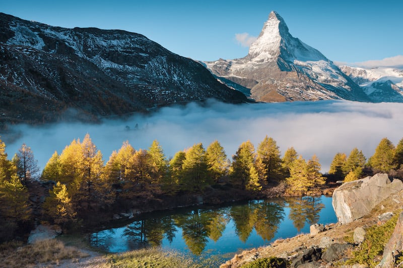
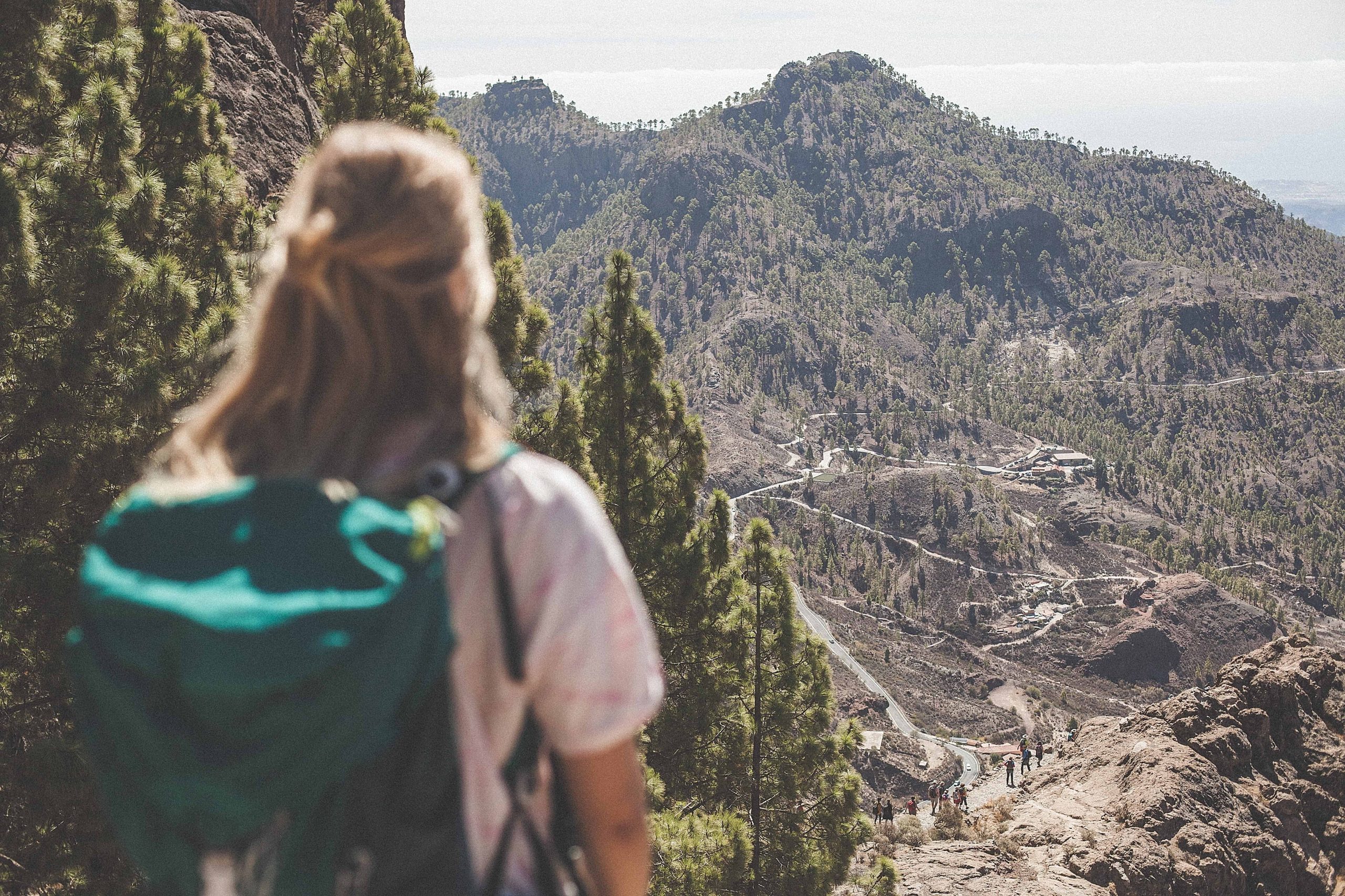
Zermatt Five Lakes Hike
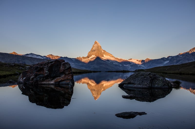
Photo: Pascal Gertschen
Distance: 5.5 miles
Fans of Switzerland’s stunningly symmetrical Matterhorn (4,478m) should tackle this excellent route, which takes in five beautiful Alpine lakes; three of which are situated perfectly to reflect the mighty Matterhorn.
The five-and-a-half-mile trail begins at the Blauherd mountain station (2,571m), which is reachable from Zermatt by taking the funicular to Sunnegga, before hopping on the gondola up to Blauherd.
Here, you’ll find incredible panoramic views along with the trailhead of your hike. First up is one of the most famous lakes, Stellisee, which mirrors the Matterhorn perfectly, followed by the Grindjisee, where the banks are coloured by swathes of wildflowers. Next up is the Grünsee, which looks out over a rugged landscape, followed shortly after by the Moosjisee, with its milky-blue waters and Matterhorn peak nestled perfectly behind.
Finally, you’ll reach the lake of Leisee, a sunny spot perfect for a refreshing dip before the final leg to Sunnegga, where you can catch the funicular railway to be back in Zermatt within five minutes. Check it out here.
Grütschalp to Mürren

Train to get to the car free village Mürren, Jungfrau Region
Distance: 3 miles
The Lauterbrunnen Valley in the Jungfrau region of the Bernese Oberland is famed for its incredible scenery, so you can be sure that this three-mile hike will deliver on views. You can easily reach the trailhead of the hike by taking the Grütschalp cable car from Lauterbrunnen. At the lift station, a wide gravel path leads up to a stretch of magical woodland, before traversing stunning Alpine pastures, whereupon a breathtaking view of the Eiger (3,967m), Mönch (4,107m) and Jungfrau (4,158m) mountains opens up.
Continue along the path taking in the expectational views and you’ll all too soon reach Winteregg. From here, the path runs almost parallel to the rack railway line, offering hikers perfectly quaint mountain views all the way to Mürren. To get back to your start point, take a romantic train ride through the mountains from Mürren to Grütschalp, and then catch the cable car back down to Lauterbrunnen.
Four Lakes Trail
Photo: Lucerne Tourism / Outsideisfree.ch
Distance: 11 miles
Not to be confused with the Zermatt Five Lakes Hike mentioned above, the Four Lakes Trail is an equally beautiful lake-heavy walking trail found in the Lucerne region. It connects the towns of Melchsee Frutt and Engelberg, cutting through the devastatingly beautiful scenery of central Switzerland.
You can reach Stöckalp in a little over an hour from Lucerne by train or bus, and then take the cable car up the Melchsee-Frutt, where the hike begins (although you can walk it in the opposite direction). Stroll around the shimmering shores of Lake Melch and then on to the turquoise waters of Lake Tannen while the far-off Bernese Alps serve as a breathtaking backdrop.
Continue down via Tannalp towards Hotel Engstlenalp to find the rich hues of Lake Engstlen nestled beneath. Ascend the Jochpass to reveal the showpiece of the hike; Lake Trüb mirroring sensational alpine scenery like an oil painting, complete with sweeping wildflower meadows and the glaciers of Mount Titlis. The Trübsee cable car marks the end of the hike, where you can ride back down to Engelberg.
Railway adventure trail
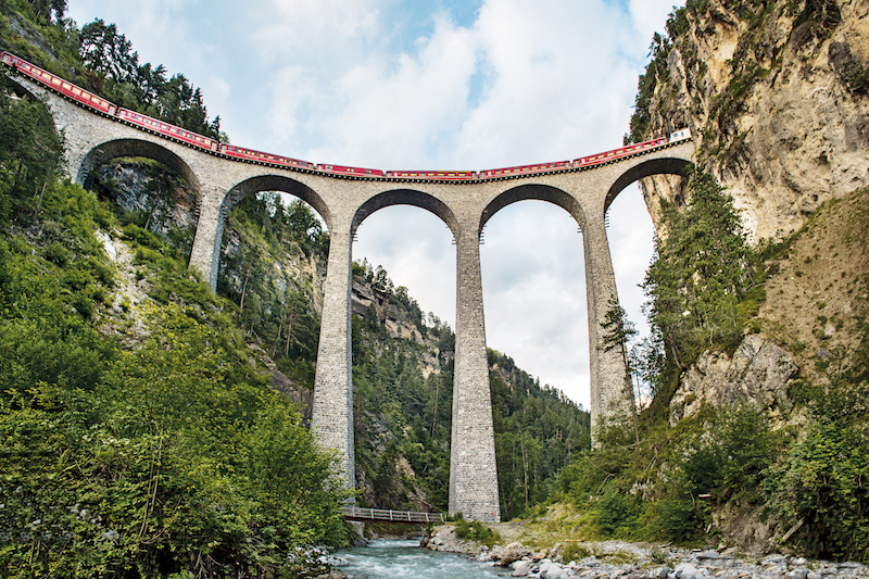
Photo: swiss-image.ch / Marcus Gyger
Distance: 4 miles
To really appreciate the incredible feat of engineering that is the Rhaetian Railway, a spectacular trail runs parallel from Bergün to Preda, showcasing the line’s most impressive bridges and tunnels, as well as the picture-postcard landscapes against which they are set. It’s certainly one of the most unique hikes in Switzerland.
The four-mile hike also features information boards containing fascinating facts and insights into the railway’s intriguing history, as well as the everyday life of the railway in the modern day. The Albula Railway Museum is also located in Bergün and is well worth popping into before or after your hike.
Both Bergün and Preda are easily accessible by train from locations throughout Switzerland and, on completing the hike, it couldn’t be simpler to hop back on the train to where you started.
San Salvatore to Morcote
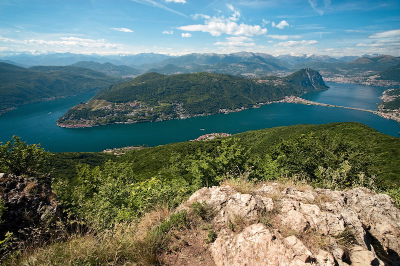
Photo: swiss-image.ch/Renato Bagattini
Distance: 6 miles
One of the most stunning hikes in Switzerland from the summit of San Salvatore (912m) to the lakeside town of Morcote follows a beautiful six-mile trail with panoramic views right from the trailhead. If you’re staying in Lugano, the trailhead of the hike at the summit of San Salvatore can easily be reached by taking the funicular railway, whisking you to the panorama terrace in a matter of minutes.
After getting acquainted with the mind-blowing views from the top, which extend over Lake Lugano to the snow-capped peaks of the Savoy Alps, you’ll start your descent. Heading through gorgeous Alpine woodland to reach the artists’ village of Carona, you’ll pass by the famous pilgrimage church of Madonna d’Ongero before continuing on to Alpe Vicania.
Here, the most gorgeous grotto restaurant makes for a mouth-watering pitstop, before you carry on your way down along the banks of the lake to Morcote. Simply catch the bus or boat to get back to your start point in Lugano.
How to get to Switzerland
Good news. Just like getting around once you’re on the ground, getting to Switzerland from the UK is also a doddle. For easy access to the mountains, your best bet is to fly into Zurich, Geneva or Lugano. Swiss Air flights are extremely regular and depart from a range of airports, including London Heathrow and London City.
Flight times hover around an hour and 40 minutes, and typically cost around £100 for a return ticket. Flights from regional airports such as Birmingham are also available, although these tend to cost a little more.
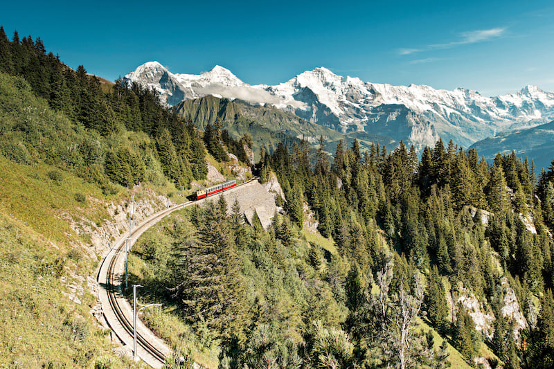
Photo: swiss-image.ch/Rob Lewis
How to get around
Getting from the airport to your desired mountain for one of these excellent hikes in Switzerland is also a breeze with the many different public transport options. The Swiss Rail Pass is a popular choice as it includes travel on regular trains, buses and boats, plus special railways and panoramic trains.
Buy one of these and you’ll get unlimited travel for a set amount of consecutive days (three, four, eight or 15), plus free access to over 500 museums and a 50% discount on mountain railways, cable cars and even e-bike rental. Prices start from £177, and you can buy your tickets here.
