


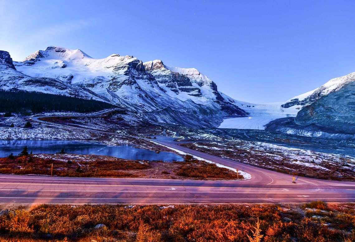
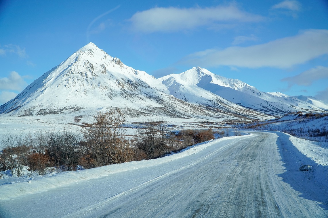
Some ROADS are less travelled for good reason. In temperatures so LOW that engines FREEZE and tarmac turns to GLASS, every inch of every mile takes every ounce of driving FOCUS you can muster — no easy task when views like these abound along the DEMPSTER HIGHWAY, Canada
An engine will freeze at -20C. At least, that’s what the Prince George auto-mechanic told us, and what did she know? This comment laboured in our minds throughout the following month. As if that was the temperature where nature triumphed and machines ceased to work. I couldn’t fathom an engine freezing. Nor did I want to experience the outcome of it happening.
Our journey hadn’t been without its issues. But for the most part, the adventure had gotten off to a smooth start. Alongside my childhood friend, James, I was attempting to drive the longest road in the world, the Pan American Highway. The expedition was due to last over a year and would take us from the top of the Canadian Arctic to the bottom of Chilean Patagonia.
VAN-TASTIC
After a few false starts, looking at vans that were either too expensive or ill-equipped for our expedition, we settled on an unassuming vehicle purchased from a Canadian family on the outskirts of Kamloops. It was a Chevrolet G20 cargo van from 1992. The van had 179,000 miles on the clock and was only partly converted with paltry attempts at interior heat insulation.
It had a bed and a working engine, but little else. It was exactly what we were looking for. Purchased for the agreeable sum of CAD $4,900 (£2,860), we wasted no time hitting the road in our attempt to reach the top of North America.
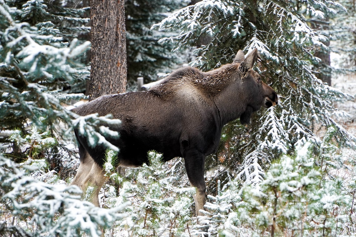
Canadian moose in Maligne Lake
We decided to pick a name for our new home and one that would mean something to us. Eventually, we decided to call her Chilli. Mainly because the exterior of the van was bright red, like a spicy chilli pepper. It also seemed a fitting name due to our end destination being the country of Chile. Lastly, and perhaps most pertinently, we were always shivering cold and chilly inside the van. And thus, Chilli was born.
We raced 1,860 miles north, through the vast wilderness of the Yukon. It was here we got our first taste of the ‘Great White North’. Our hot-headed ambitions to reach the Arctic Circle began to cool as harsh conditions started to arise. Embarking on the journey in early October, on the cusp of winter, we hoped to avoid all but the worst of the snow. Naïve thinking, indeed.
The final stretch to reach the Arctic Circle took us up the treacherous Dempster Highway: an ice road that departs from the gold prospecting settlement of Dawson City, hub of the Klondike Gold Rush, and curls its way through the tundra up to the First Nations community of Inuvik situated on the shores of the Arctic Ocean.
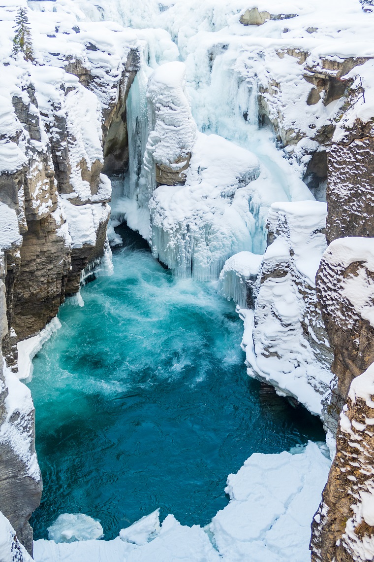
Sunwapta Upper Falls in Jasper National Park, Canada
On this route, we learned our first lesson in vehicular fear. Our preparations for the winter driving were as thorough as possible, given our limited budget. We had a set of sturdy four-season tyres, but decided not to invest the CAD $1,000 (£584) in specialist snow tyres. Instead, we opted for snow chains, a cheaper alternative that saved us around CAD $900 (£525).
Our white-weather arsenal also contained a snow shovel and a propane heater — in case we got stuck in a snowdrift and needed to dig ourselves out or stay warm until help arrived. We also bought two 20kg bags of salt grit to place over the back wheels to give the van more traction on slushy roads.
In all honesty, we were going into the trip with a laughable lack of experience. Roads back home in the UK rarely have snow on them and even when they do get icy, they’re more manageable than what we were about to face in the upper Yukon. Our risks were great, but so was the reward.
SLIP-UPS
Day by day, we inched our way closer to the Arctic Circle, further from civilisation and deeper into adverse weather. The mechanic’s words rang louder in our ears as the snow got deeper and the roads became icier. Our first accident happened 18 miles south of the Arctic. I pressed too hard on the accelerator causing the back of the van to lose traction and drift across the road.
The rear wheels swung back and forth multiple times before we eventually rolled to a stop a few moments later. I’d been creeping along at around 10mph, but it was a harsh reminder of what could happen if I lost my concentration, even for a second.
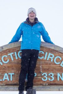
We crawled along at a snail’s pace up to the Arctic Circle and celebrated the first significant milestone of our journey without further incident. From here, the most northerly point of the continent, it was time to head south again, 18,641 miles to the bottom of South America. And to do that, we had to negotiate another dose of the Dempster Highway: 450 miles of perilous driving conditions surrounded by a world of white.
Not long into our return journey, we got a stark reminder of what we were up against when we rounded a corner to find an articulated lorry jack-knifed across the road. The front wheels were poking over the edge of a ridge that fell away to a low-lying forest. The vehicle looked a metre short of toppling over the cliff.
Seeing the impending danger, I lifted my foot off the accelerator and attempted to break softly. I knew that any sudden, jerking motion would only consign us to the same fate. Despite my best efforts, I felt the wheels grind beneath Chilli as the van slipped and began to skid. We were now drifting downhill on the same black ice heading straight towards the lorry, unable to stop.
My hands whitened on the steering wheel as I aimed our van in the direction of the roadside snowdrift. With painstaking speed, trying to move with the skid, I managed to manoeuvre us into a bank of snow where the van slowed and crunched to a stop. After a moment’s rest to compose myself, I crept downhill in neutral and managed to slide past the lorry with mere inches to spare.
WELCOME TO JASPER
After leaving the Yukon, James and I agreed that we’d avoid all future ice driving at any cost. Our van was hardly up to it, and our nerves even less so. We’d pushed our luck reaching the Arctic Circle and didn’t want to run the risk of destroying our van or injuring ourselves trying to emulate the process. Fortunately, we were now heading south, back down into British Columbia. The weather could only improve… or so we thought.
Three weeks later, we arrived in Alberta’s magnificent Jasper National Park. Our plan was to drive the Icefields Parkway, using it as the base for our hiking adventures. This road, officially but unromantically called Highway 93, runs along the spine of the Rocky Mountains connecting the National Parks of Jasper and Banff.
The beauty of winter in Jasper National Park
During our first week, a cold front blew in from the Pacific, littering the inland plains with frost and dusting the mountains with a light layer of snow. It was magical and made for perfect hiking conditions; breathless and cold, but clear views for miles.
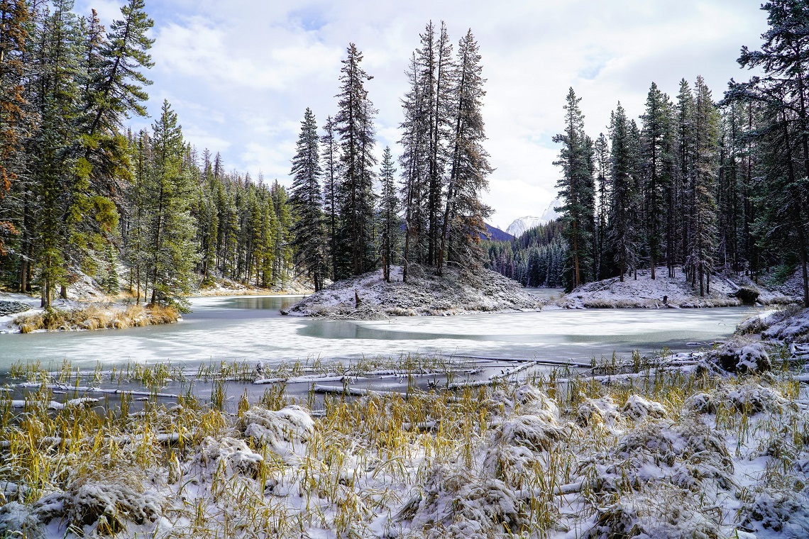
Making the most of this opportunity, we drove out to Maligne Lake, an area originally named “Chaba Imne” or Beaver Lake by its First Nations inhabitants before its rediscovery by the US citizen Mary Schaeffer in 1907.
The lake is wild and remote. Deep blue water stretches up to a crown of mountains that fringes the back of the valley, untouched by any kind of human infrastructure. We padded our way along the lakeshore in ankle-deep snow admiring the lynx tracks crisscrossing the paths.
In the silt of a converging creek, I noticed much larger tracks belonging to a Canadian moose: the animals forage in the shallow water to drink and feed off the submerged vegetation. Shortly after, the footprint had a host. A cow crossed metres in front of us followed by her calf, not more than a year old. They knelt in the snow to nose for the red berries hidden in the undergrowth, their hot breath forming in plumes around them.
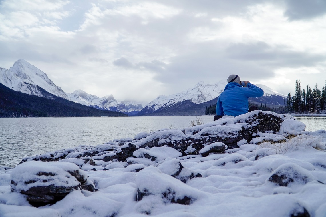
Tea break at Maligne
The following day we joined the Icefields Parkway and drove southeast along the Athabasca River. A bitterly cold weather system had begun to settle over the Rocky Mountains with temperatures plummeting below zero. The air was dry and it had been weeks since the ground had last seen rain. This left the roads absent of ice and made the driving conditions considerably safer than they had been farther north.
Though the freezing temperatures made for shivery nights in our van, the cold was a blessing for our outdoor adventures. During the day, the sky was cerulean with no clouds in sight. Every lake and pond was frozen solid and even the streams became encased in sheaths of ice.
Brilliant sunny days failed to raise the mercury a single degree. The chilled air flushed our cheeks and burned in our lungs. Enjoying the stunning weather, we hopped along Highway 93 pulling in at every lake, glacier, and waterfall that crossed our path.
VALLEY OF THE FIVE LAKES
Shortly after leaving Jasper, we stopped at the Valley of the Five Lakes for a hike. It was early in the morning, and we were the first to arrive in the parking area. After brewing a thermos of hot chocolate, we followed the paths through a woodland to reach the lakes. The ground was littered with dead leaves and sticks splintered by hoar frost; the air cold enough to freeze the last droplets of water in the fallen vegetation.
A Katabatic wind is one that carries high-density air from a higher elevation down a slope to lower ground under the force of gravity
–
We followed a trail up a ridge before reaching the edge of the first lake. Emerald water stretched out in front of us. The sky was just beginning to rise over our backs casting mottled rays of light through the canopy. The water’s surface smoked in the sunlight, an indication of *katabatic winds gusting down from the glacial plateaus above.
Thrilled to be exploring the wintery landscape, we zipped up our jackets and tightened our gloves before winding our way around each of the five lakes. At this moment, the cold was on our side. We were jubilant with the current weather conditions. It was beyond our comprehension what would happen later that night.
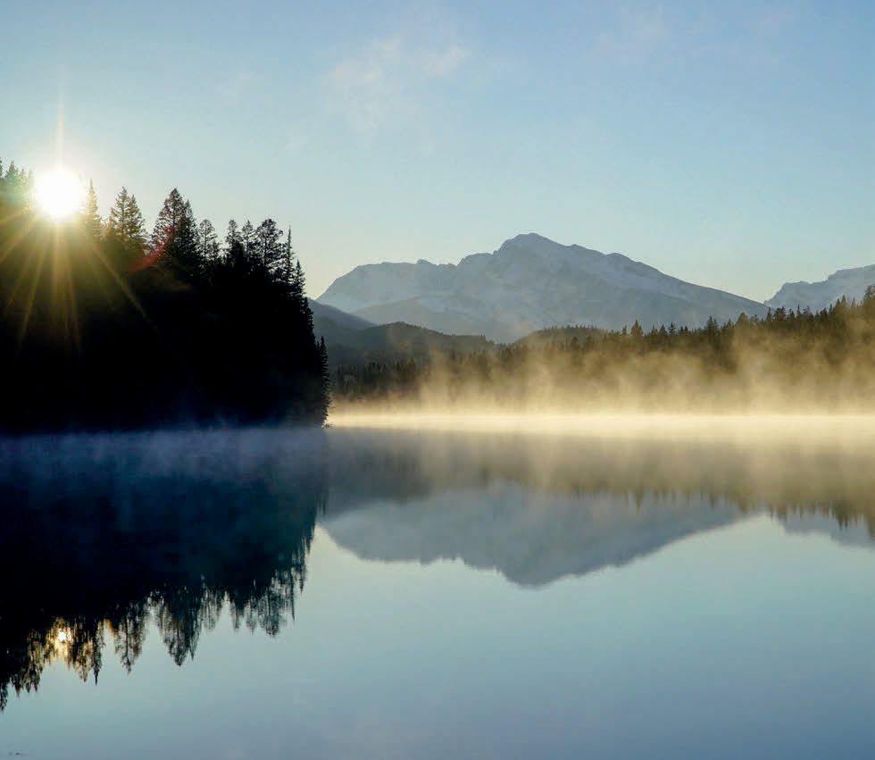
Valley of the Five Lakes at sunrise
Returning to our van, we cooked some porridge on our camping stove before hitting the road again. The Icefields Parkway took us through an amphitheatre of dazzling peaks, each topped with gleaming snow. The road was remarkably smooth and unrutted, a pleasure to drive given the scenic location. It was a true jaw-to-the-floor moment as we rounded bend after bend to be greeted by yet more stunning alpine landscapes.
As the day wore on, the sun began to lower in the sky, flittering behind the sharp mountain peaks. Our aim was to reach the Saskatchewan River Crossing. From there, we could pass out of the National Park and find a place to camp on the outskirts of the protected nature area.
The highway began to narrow as it entered a long valley. We drove along the basin of a glacial wash, filled with milky braided streets and mounds of silt littered with rounded pebbles. This lunar landscape soon dropped away as the road began to wind its way up the side of a mountain past the Stutfield Glacier. It was here that the nerves set in.
Mottled grey mounds started to appear on either side of the road and along its centre. The smear of tarmac beneath each set of wheels was getting thinner. I changed down a gear, hoping to use the engine brake to further control the vehicle as we rose over an icy crest. I switched off the music to concentrate and sat closer to the steering wheel.
In my heart, I knew we were heading into trouble. It was far too cold for any of the ice to have melted and it would only worsen the higher we drove. The magnificent beams of sun we’d enjoyed earlier in the day had softened the compact ice in parts, but this would only make the situation more dangerous as it refroze with the fading light.
CHILLING FEELING
We began our approach to the Columbia Icefields. With a sinking sensation in my stomach, I scoped the road as it swept along a hairpin bend before shooting up a ridge high above us. To our right, the land opened out into a lumpy field of icebergs backed by a hulking mass of glaciers.
Freezing winds struck the van side on, littering the road with ice crystals. A moment later, the tarmac had gone. Beneath the wheels, it felt like the van was floating. We were back on the terrifying ice roads; a position we swore we’d never put ourselves in again.
The mountains of Tombstone Territorial Park on the Dempster Highway
Up the roads went, into more snow and ice. At every moment, I felt the van could skid away from me. Going uphill, I was fearful of losing traction and slipping backwards. On the descent, I knew that breaking too hard or too fast would cause the vehicle to slip out of control. Any change in momentum, even slight, could be lethal. I had to manoeuvre the van as smoothly as possible, a feat that’s easier said than done on steep, winding roads.
We drove in absolute silence, each of us utterly focused on the road. If we crashed, it wasn’t merely the van that was at stake, it was the entirety of our Pan American Highway adventure. All the years of planning gone in one treacherous moment. Should the crash carry us through one of the barriers and over the cliffs, it could even cost us our lives.
At last, after an hour of painstaking driving, the road began to descend into the far valley. On a long downwards slope, the van went into a short skid which sent a flash of fear rushing through me. I regained control but soon felt a lump in my throat. The barrier beside me was bashed and warped from vehicles that had lost control and crashed on this very stretch of road. Their occupants hadn’t been as fortunate as us.
At last, we reached a smooth tarmac surface, and both let out a sigh of relief. Still shaken from our experience, we drove the last 20 miles in silence to the crossing where we exited the National Park. That night, James divulged some information he’d chosen to withhold from me on the journey.
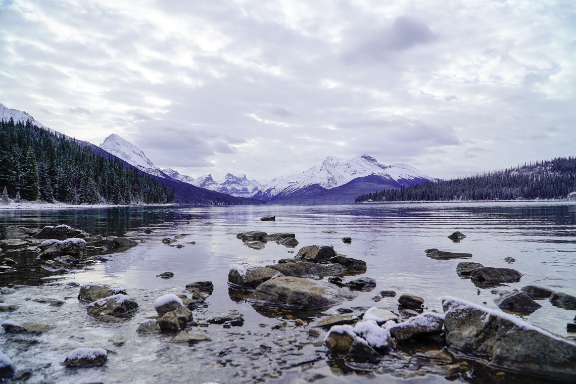
Looking down Maligne Lake in Jasper National Park
“I didn’t want to say this at the time, but multiple people have died on that road in the last decade.” I gawped at him.
“Last year, a tourist bus crashed on the Columbia Icefields and three people were killed.” He paused uneasily.
“That was with an experienced driver and a vehicle that has proper wheels. It just makes you wonder.” Indeed, it did.
Over the next few hours, the temperature dropped to a punishing -17C. We kept turning the van on throughout the night to warm the engine. The sky was so mesmeric, though, we almost forgot our fears of the van dying and us becoming stranded. A dazzling display of stars glowed white across the frozen sky. We stood and looked up, taking it all in.
We’d survived another black ice highway, more through luck than anything else, but it was done. That’s the trade-off for seeing places that are truly wild. Landscapes this remote aren’t meant to be so flippantly traversed. They exist in spite of everything, and if you’re fortunate enough, you might just get to admire them and live to tell the tale.
WHO’S WRITING?
 Matt is a freelance travel writer and filmmaker specialising in outdoor adventures. His travels have taken him trekking in the Himalayas, backpacking through Asia on the Trans Siberian Railway, and wild camping along 500 miles of long-distance hiking trails in the United Kingdom. Follow his adventures now at mattwalkwild.com