


50 SHADES OF BLUE
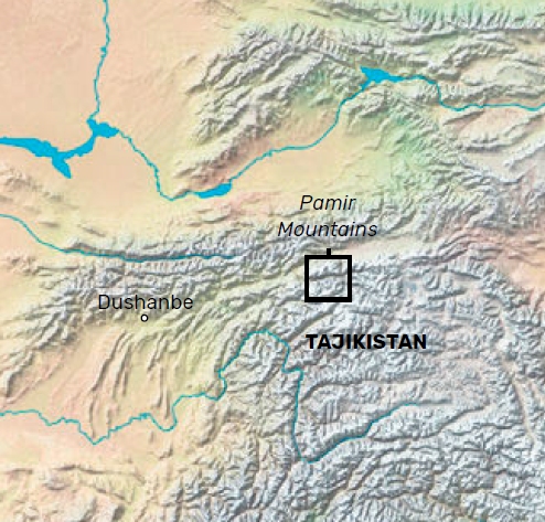
Of all its mountain ranges, THE PAMIRS is Asia’s best-kept secret, yet an EXTENSIVE network of shepherd trails makes this high-altitude LAKE DISTRICT surprisingly accessible
 The first time I heard about the Pamir Mountains in Tajikistan was in 2005, when I was travelling the Karakoram Highway, just across the border in Chinese Xinjiang. From the slopes of the mountain colossus Muztagh Ata, I peered into this mystical land of tall, stark, empty mountains. I was sold.
The highest peaks reach far above 7,000m and the longest glacier in the world outside the polar regions can be found here. This is an explorer’s paradise.
The Toyota Land Cruiser bounces and shakes its way along the thundering Panj River, which forms the majority of the border between Tajikistan and Afghanistan.
The crumbling tarmac is regularly exchanged for rocks and mud. On the opposite side of the river, I see small, isolated Afghan settlements enclosed by enormous mountain faces. It’s harvest time and the people are working hard to prepare the villages for the imminent and brutal winter that lurks around the corner.
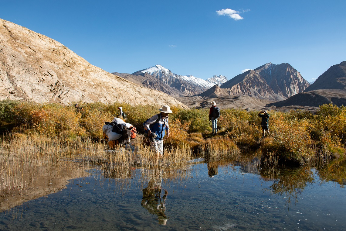
Pack animals make freezing river crossings easier
The degraded Pamir Highway and the rickety wooden electricity poles seem like a luxury compared to the self-sufficient existence across the river. After the 14-hour journey passing military checkpoints, wobbly bridges, and excited children, the team arrives at the first port of call: Khorog, the capital ‘city’ of the autonomous region of Badakhshan, otherwise known as the Pamirs. It’s a peaceful town on the banks of the crystal-clear Gunt River and a strategic base for many trekking routes in the area.
LOCAL HOSPITALITY
The mountain village of Bulunkul is the trailhead of our trekking expedition through the heart of the Pamir Mountain Range. At an altitude of 3,760m it’s the highest permanently inhabited settlement in Central Asia. From Khorog (2,200m) it’s a big jump in elevation, and we make a detour via the neighbouring Shakhdara Valley to acclimatise. We spend the night in one of the many homestays that can be found in improbable remote locations all over the Pamirs.
The family welcomes us with tea, homemade yoghurt, and oven-fresh non, the typical round Central Asian bread. e mudbrick house is built in accordance with a unique religious architecture called Chid.
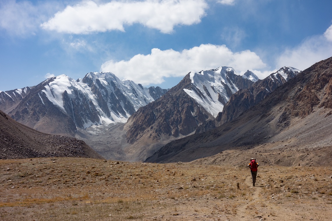
Trekking in this remote part of the world, there is no mountain rescue and often no phone signal
The design of the skylight is inspired by one of the world’s oldest religions, Zoroastrianism. It’s constructed with four windowpanes, each representing the basic elements of earth, water, air, and fire. The five pillars in the house symbolise the five members of Ali’s family, a cousin of the Prophet Mohammed and founder of Isma’ilism, a branch of Shia Islam. The guestroom is a cosy space with colourful Karputchas (carpets) where we will spend the night. In this part of the world there is no light pollution and the starlit sky pierces through the skylight, reinforcing the strong connection with the four elements.
The journey to Bulunkul goes via the 4271m-high Koitezek Pass, one of the highest points on the Pamir Highway. Bulunkul is a place of extremes. In recent history, the mercury dropped to a staggering -63C, pushing it into the top-10 coldest permanently inhabited places on the planet. It’s located on the western end of the Murghab plateau with hardly any shelter against the bitterly cold winds that blow without interruption across the dusty plains. It’s only September, but I can already unpack my down jacket. In the distance, a dust cloud is moving towards the settlement.
The tranquil turquoise waters of Yashilkul Lake
The caravan that appears out of the cloud is the Tajik crew and their pack animals that will support our expedition during the nine-day traverse across the Rushan Range, a sub-chain of the Pamirs.
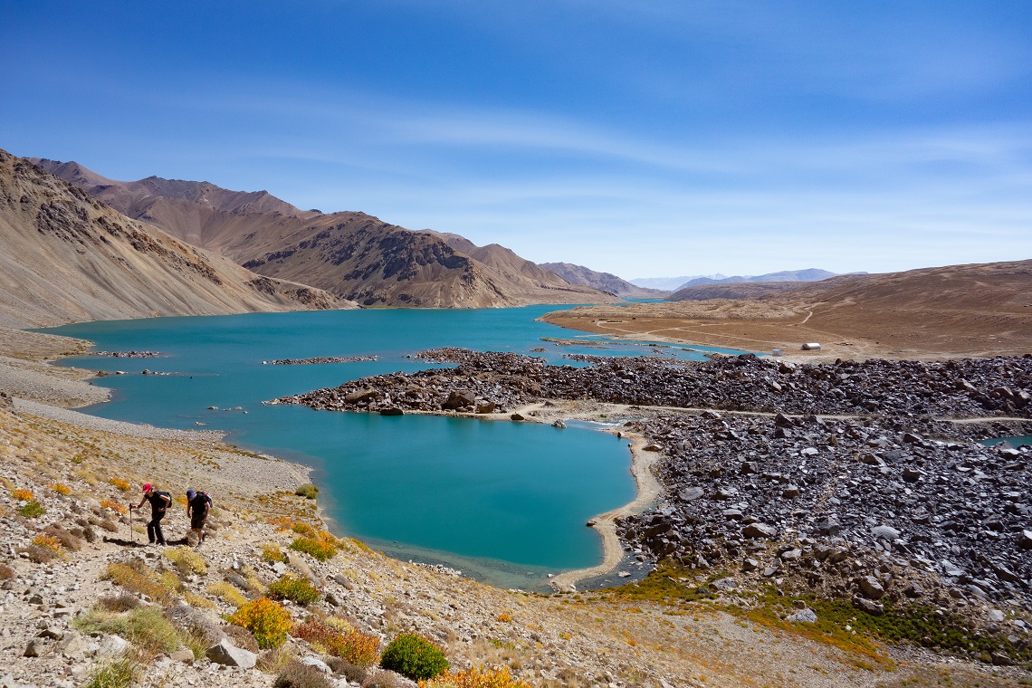
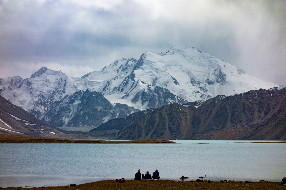
The first camp is a centuries-old caravanserai on the banks of the Alichur River. One of the southern routes on the Silk Road ran across this valley and this place was once a refreshing station for traders and pilgrims. To reach the camp, the group is forced to wade through the ice-cold, waste-deep river. It’s a breath-taking spot to spend the night. A short climb up the small ridge behind the camp gives me a true sense of scale of this vast mountain range. Below, the Alichur meanders towards the turquoise Yashilkul Lake, Tajikistan’s fourth biggest lake.
The next two days I’ll be following its northern shores. In the far distance the summits of the Rushan Range, that we’ll be crossing in a few days’ time, are beckoning.
A WAKE-UP CALL
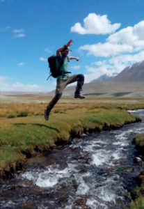
Mentally, I’m preparing for the first long day of walking ahead of us. The condensation of my breath has left a frozen layer on the inner part of my tent and I struggle to leave my toasty sleeping bag. It’s still dark when I’m fuelling myself with hot porridge and sweet tea. Today’s route involves two tricky river crossings and a steep cliff. The first river crossing is fairly easy. I manage to keep my feet dry, hopping from boulder to boulder. The next obstacle is a 50m-high cliff that rises almost vertically from Yashilkul Lake. I climb to the top of the cliff via a vague goat path, following a trail of goat droppings.
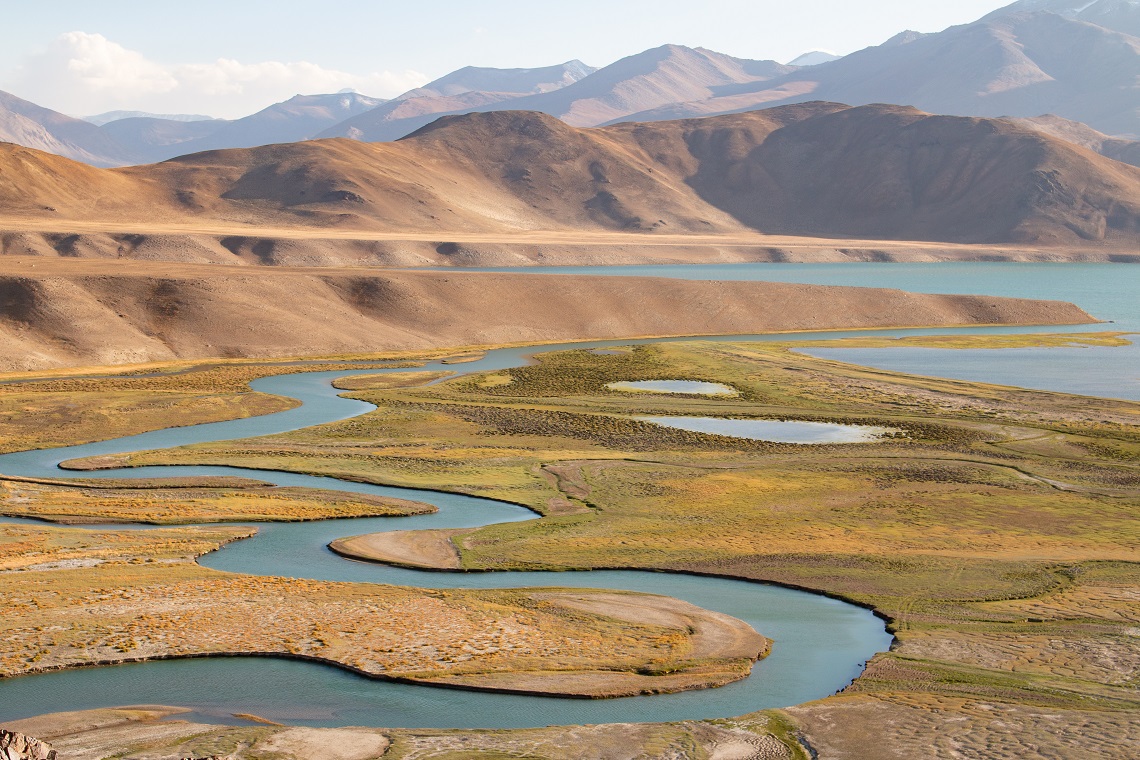
The waterways cut a pathway through this unique landscape
The descent back to the shore goes via a solid, steep slope littered with small stones. It’s an extremely treacherous section. One of the team members tumbles down but manages to break her fall with her walking pole. Somewhat shaken, the team takes a break at the edge of the lake. The incident is a wake-up call, exposing the wild character of the Pamir Mountains. There are no waymarkers, fences, or steps. Pathways are carved criss-cross into the mountain slopes by shepherds who have tended their livestock in this part of the world for centuries.
Trails and bridges are wiped away by avalanches, landslides, and mud flows on a regular basis. In case of an accident, help is far away. There is no mountain rescue service, and in most cases, not even mobile phone coverage. We’re completely on our own and that’s precisely the appeal of trekking in this wild, untouched mountain range.
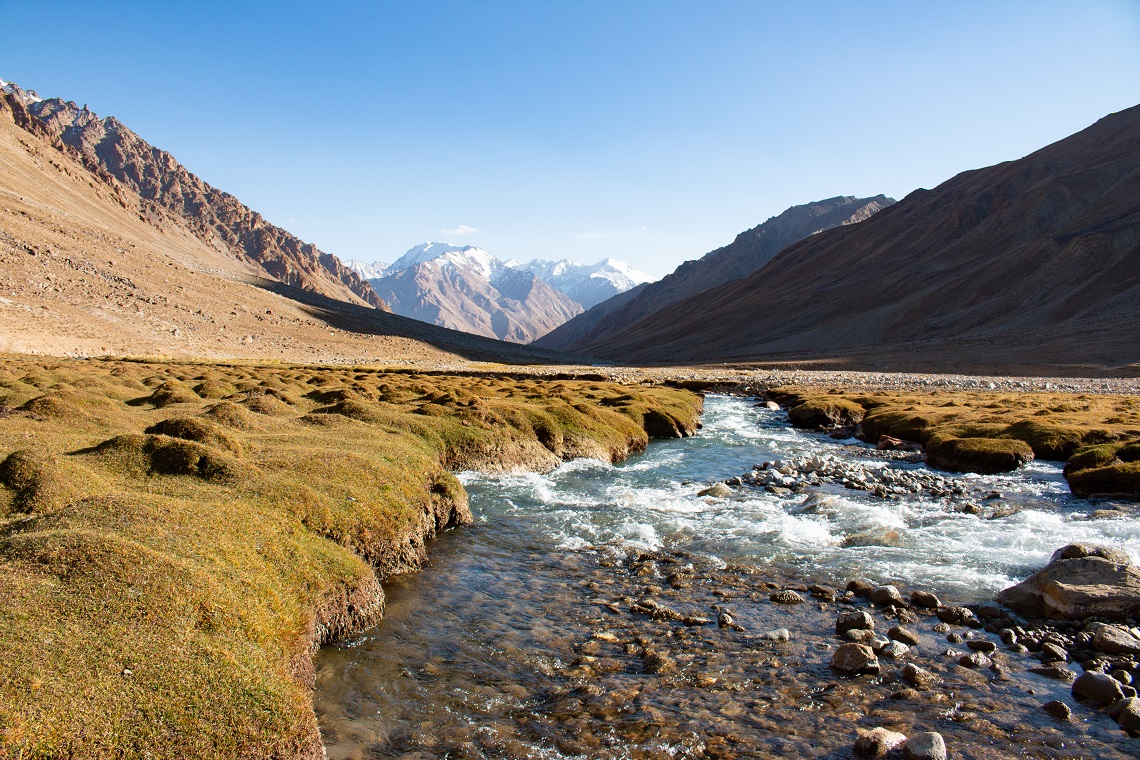
I take a last glimpse of Yashilkul behind me and enter the wide, U-shaped Langar Valley via a short but strenuous climb. Spiky summits of over 5,000m dominate the skyline on both sides of the valley. It’s a gradual ascent along the Langar River, that merges downstream with the Gunt River. This is one of the many tributaries of the legendary Oxus River, that bears the name Amu Darya these days and drains into the Aral Sea in Uzbekistan.
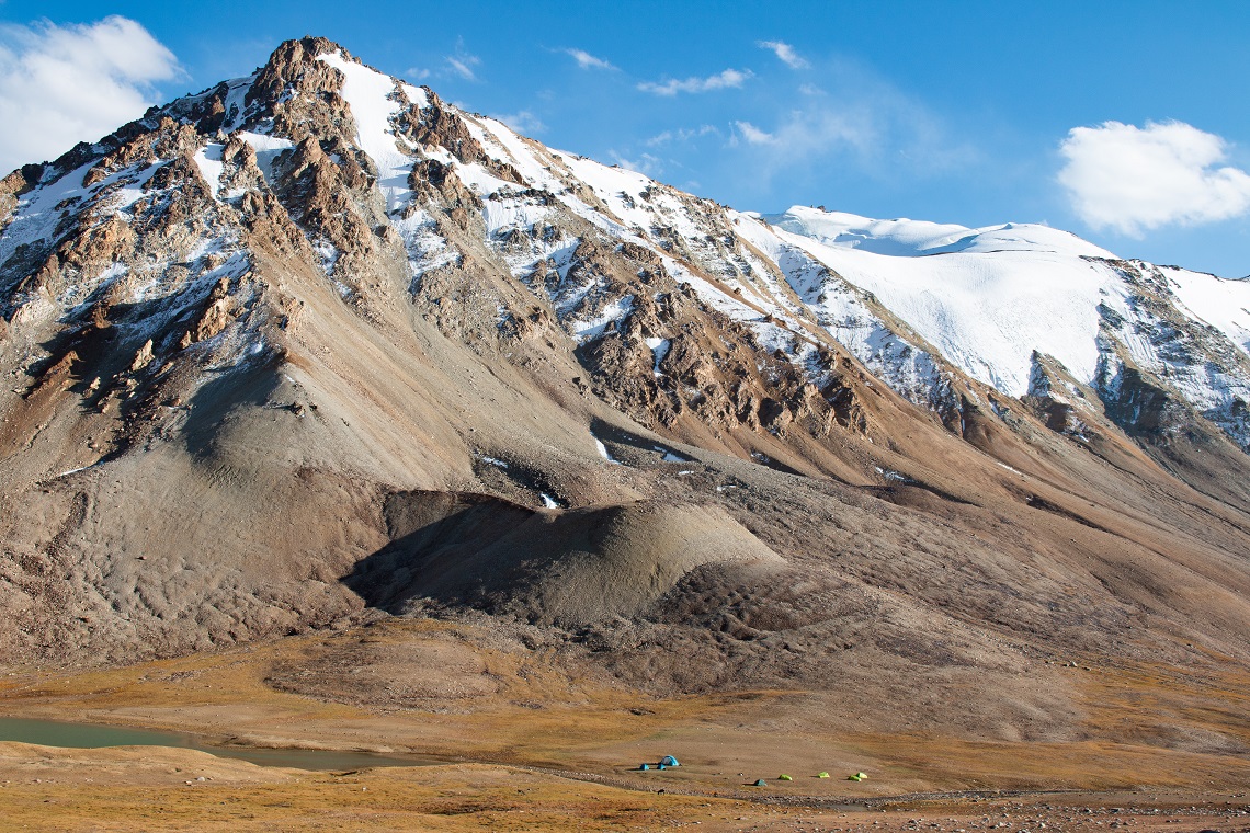
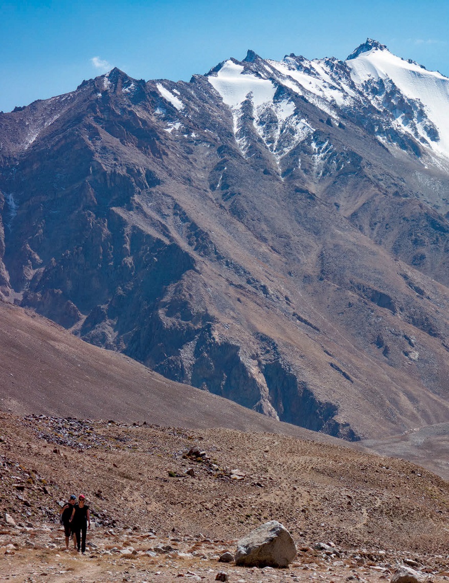
The tiny tents give an idea of scale
Halfway up the valley we pitch our tents near a shepherd camp at around 4,000m. In winter, shepherd families live at lower elevations to avoid the harsh temperatures and deep snow conditions. They spend the entire summer at higher altitudes in search of good grazing grounds for their goats and sheep. I’m invited inside their temporary mountain home. The host treats me to some lovely warm fresh bread and kret (dried, salty yoghurt balls made of sheep milk), of which I’m not fond but politely accept.
I catch a glimpse of the unique way of life high up in the Pamirs, something that very few outsiders have experienced.
INTO THE BLUE
Higher up, the valley bends to the west and the wild Langar River has devolved into a tiny trickle, fed by the hanging glaciers on the north-facing wall next to the 4,610m-high Langar Pass. This is the rugged, untouched mountain wilderness I’ve been searching for. My heart is pounding as I reach the highest point of the pass and descend to a small turquoise lake just below it. At the end of the lake, the Tajik crew finds a brilliant camp spot and we decide to call it a day.
After setting up the camp I spend the rest of the day exploring the surrounding mountain ridges. This is the very heart of the Pamirs and it is dotted with glittering mountain lakes in all shades of blue. The trekking route winds its way through a broad plain with grazing yaks and hospitable Pamiri shepherds. We pass the three Uchkul lakes and descend to a large summer settlement on the top end of the Irkht Valley. It’s a motley crew of long-haired goats, nervously barking dogs, and yelling children who call this mudbrick mini-complex home for four months of the year.
The following morning, we start the ascent to one of the most spectacular mountain lakes in Central Asia, Zarojkul. The landscape changes abruptly from a broad plateau to a narrow, seemingly impenetrable gorge filled with massive boulders and glass-like ponds. The eroded trail is in a poor state and I need to pay attention to my footing. One wrong step will land me 30m lower down in the near-freezing water. When this last obstacle is tackled it’s an easy stroll to the northern shores of Zarojkul.
This lake is sapphire blue and completely surrounded by glaciated mountains. Before I’m able to pitch my tent, dark clouds build up and obscure them. It starts snowing, making tomorrow’s crossing of the 4,795m-high Shtik Lazar Pass uncertain. I tuck into my sleeping bag, listening to the snow falling on the tent sheet. It’s still dark when I zip open the tent fly.
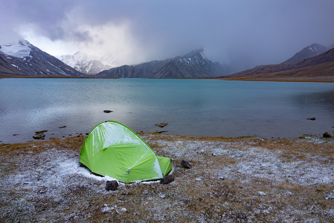
Cold comfort even in early September, Jan was de-icing his tent
First light trickles in and accentuates the silhouette of the ridge east of Zarojkul. The weather has cleared, and we get the okay for crossing the pass. Still half asleep, I’m taking down the tent and after a quick breakfast, I start the ascent to the highest point of the expedition. Shtik Lazar is covered with an impressive glacier and an early traverse is necessary to beat the fickle weather patterns in the afternoon. The glacier is rather flat and free of snow. The rope and crampons stay in the bags.
Because we already spent five nights above 4,000m, the team is perfectly acclimatised and before noon we reach the enormous cairn on top of the pass. From here it’s a 2,000m vertical drop to the picturesque mountain village of Bardara and the end of our trek.
GOING DOWN
The moraine at the northwest end of the pass is a big pile of rubble. An unclear path winds its way down the blocks and regularly disappears into chaos. This trekking route sees very few people, even locals. I realise that the final descent will be tougher than the actual traverse of the glacier. The route zigzags towards the terminus of the moraine and it drops further across the rugged terrain. My knees feel battered when I’m standing on the east bank of the Bardara River. After a chilly river crossing, we reach the last camp on its western banks. From here, it’s all the way down.
It’s a special feeling to see friendly elements in the landscape again after having spent several days at high altitude. The first tree I spot is solitary but stands proud next to the path and I can’t hide a big smile. Gradually the valley becomes greener and I can see the first signs of civilisation, agricultural patches of land, and a small mudbrick hut.
The last serious obstacle is a tributary that drains the glacial meltwater of the Turshedavi Glacier. It’s warm and the river has reached a critical level, just below its banks. Upstream the team searches for a safe place to cross but without success. We wait for our pack animals to arrive and hitch a ride across. The donkeys struggle to stay on their feet in the fast-flowing water, but we all manage to reach the other side, dry. The final descent progresses quickly.I feel motivated again, breathing in the thicker air of the lower Bardara Valley.
After nine days in the Pamiri mountain wilderness, I collapse on the comfortable Karputchas of our local homestay. No five-star hotel can beat this.
WHO’S WRITING?
 Jan Bakker is the founder of The Expeditionists, a guided travel company offering unique and bespoke multi-discipline trips in some of the world’s most obscure and underrated adventure destinations.
He has visited over 80 countries and guided expeditions in remote places such as the Wakhan Corridor, Afghanistan, and DR Congo.
He is the co-author of the travel guide Trekking in Tajikistan, and currently calls Kampala, Uganda, home.